Wainui
From Wikipedia, the free encyclopedia
For the town in the Wellington Region, see Wainuiomata.
| Wainui | |
|---|---|
 Wainui | |
| Coordinates: 36°36′3″S 174°35′31″E / 36.60083°S 174.59194°ECoordinates: 36°36′3″S 174°35′31″E / 36.60083°S 174.59194°E | |
| Country | New Zealand |
| Region | Auckland Region |
| Ward | Rodney Ward |
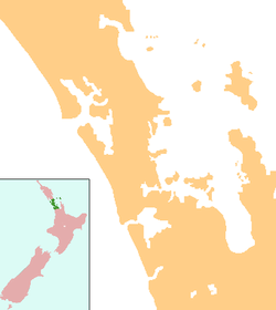
Wainui is a locality in the Rodney Ward of the Auckland Region of New Zealand. Wainui is approximately 5.5 kilometres north-east of Waitoki and 10 km west of Orewa. The Wainui Stream flows south-west through the area, and exits into the Kaukapakapa River.[1][2]
Education
Wainui School is a coeducational full primary (years 1-8) school with a decile rating of 10 and a roll of 225.[3] The school opened in 1879[4] and celebrated its 125th anniversary in 2004.[5] The original school room is now part of the Museum of Transport and Technology in Auckland.[4]
Notes
- ↑ Peter Dowling (editor) (2004). Reed New Zealand Atlas. Reed Books. pp. map 11. ISBN 0-7900-0952-8.
- ↑ Roger Smith, GeographX (2005). The Geographic Atlas of New Zealand. Robbie Burton. pp. map 35. ISBN 1-877333-20-4.
- ↑ "Te Kete Ipurangi - Wainui School". Ministry of Education.
- ↑ 4.0 4.1 "Wainui School - History". Wainui School. Retrieved 2008-09-30.
- ↑ "Wainui School, 125th Jubilee". Education Gazette New Zealand 82 (13). 21 July 2003. Retrieved 2008-09-30.
External links
This article is issued from Wikipedia. The text is available under the Creative Commons Attribution/Share Alike; additional terms may apply for the media files.