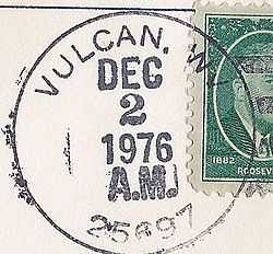
Vulcan, West Virginia
From Wikipedia, the free encyclopedia
| Vulcan, West Virginia | |
|---|---|
| Unincorporated community | |
 Vulcan, West Virginia | |
| Coordinates: 37°33′08″N 82°07′33″W / 37.55222°N 82.12583°WCoordinates: 37°33′08″N 82°07′33″W / 37.55222°N 82.12583°W | |
| Country | United States |
| State | West Virginia |
| County | Mingo |
| Elevation | 738 ft (225 m) |
| Time zone | Eastern (EST) (UTC-5) |
| • Summer (DST) | EDT (UTC-4) |
| ZIP codes | 25697 |
| Area code(s) | 304 & 681 |
| GNIS feature ID | 1555899[1] |
Vulcan is an unincorporated community in Mingo County, West Virginia, United States. Vulcan is located along the Tug Fork across from the state of Kentucky.

In 1977, John Robinette, acting mayor of Vulcan, requested aid from external sources to replace the town's bridge. The bridge was the sole route to legally enter and exit the town, and it had collapsed two years previously.[2] The West Virginia government provided $1.3 million in funding to replace the bridge.[3][4]
References
- ↑ "US Board on Geographic Names". United States Geological Survey. 2007-10-25. Retrieved 2008-01-31.
- ↑ http://tvnews.vanderbilt.edu/program.pl?ID=253642
- ↑ http://www.nytimes.com/1991/07/22/us/west-virginia-roads-a-bumpy-legacy-lives-on.html?pagewanted=3
- ↑ http://news.google.com/newspapers?nid=1356&dat=19800102&id=0g0wAAAAIBAJ&sjid=sgUEAAAAIBAJ&pg=2235,462258
| |||||||||||||||||||||||
This article is issued from Wikipedia. The text is available under the Creative Commons Attribution/Share Alike; additional terms may apply for the media files.
