Vorë
From Wikipedia, the free encyclopedia
| Vorë | |
|---|---|
| Municipality | |
 | |
 Vorë | |
| Coordinates: 41°23′38″N 19°39′16″E / 41.39389°N 19.65444°ECoordinates: 41°23′38″N 19°39′16″E / 41.39389°N 19.65444°E | |
| Country |
|
| County | Tirana County |
| District | Tirana District |
| Area | |
| • Total | 41 km2 (16 sq mi) |
| Elevation | 60 m (200 ft) |
| Population (2011) | |
| • Total | 12,135 |
| • Density | 300/km2 (770/sq mi) |
| Time zone | Central European Time (UTC+1) |
| • Summer (DST) | CEST (UTC+2) |
| Postal code | 1032 |
| Area code(s) | 047 |
| Car Plates | AA xxx AA |
| Website | http://bashkiavore.gov.al/ |
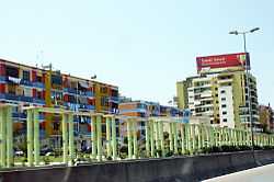
Vorë or Vora is a municipality in Tirana District, Tirana County in Albania.[1]
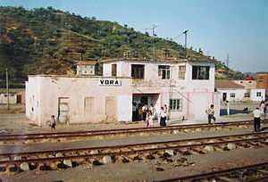
While small, it is located at a major road junction (SH2 and SH52) and railway junction.
It is not to be confused with the significantly bigger city of Vlorë, Albania's second biggest seaport.

Station of Vorë, 1995
References
| ||||||||||||||
This article is issued from Wikipedia. The text is available under the Creative Commons Attribution/Share Alike; additional terms may apply for the media files.
