Volkovce


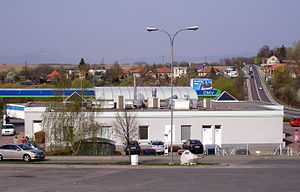
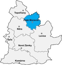
Volkovce is a village and municipality in Zlaté Moravce District of the Nitra Region, in western-central Slovakia.
1275
The first written reference to Volkovce is found in a document from 1275. It was written by master Ladislav an official from Ostrihom canonry during the reign of king Ladislav IV. The document confirms the exchange of land estates between master Štefan, the Tekov region Zhupan (Zhupan = a title of various positions amongst Southern Slavonic peoples, at the head of several types of units called ŽUPA) and the castle's lords Dom, the son of George and his brothers. All the attending parties declared that they “give and assign estates called Mohala and Wolkouch”, that have fallen into the castle's territory and therefore are better, preferable and more beneficial to be exchanged for other estates that belong to them”.
The reason for the exchange, according to the attending parties was the fact that „terra esse mixtam cum terra Magistri Stephani“ which means their estates were scattered and therefore it was beneficial for all the parties to bring these estates together.
Volkovce did not get into this document as a newly erected village, but in connection with an economic dispute of its residing owners. It can be assumed that the village was probably well established and belonged under the territory of Tekov castle.
1327
Another interesting reference to Volkovce is dated 1327. It is also a record about judicial dispute between an Abbot of Saint Benedict Abbacy, who owned a part of estate in the region of Volkovce and Pavol also named as Literate from Volkovce and his brothers. According to the document these tenants wanted to withdraw from the influence of the abbot and claim ownership of the land they had rented from him. However, the abbot was able to prove that the predecessors of Pavol acquired their lands from the previous abbot as tenants, therefore the estates in dispute continued to be the property of abbacy. Since Pavol lost his case, he was forced to pay the court costs – 12 marks of silver
Geography
The municipality lies at an altitude of 210 metres and covers an area of 11.604 km². In 2011 it had a population of 1005 inhabitants.
External links
Coordinates: 48°20′N 18°28′E / 48.333°N 18.467°E