Volcán Barú
| Barú | |
|---|---|
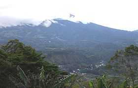
 Volcán Barú and the mountain city of Boquete | |
| Elevation | 3,474 m (11,398 ft) |
| Listing | Country high point |
| Location | |
 Barú | |
| Range | Talamanca Range |
| Coordinates | 8°48′31.72″N 82°32′32.42″W / 8.8088111°N 82.5423389°WCoordinates: 8°48′31.72″N 82°32′32.42″W / 8.8088111°N 82.5423389°W |
| Geology | |
| Type | Stratovolcano |
| Last eruption | 1550 ± 10 years |
The Volcán Barú (also Volcán de Chiriqui[1]) is the tallest mountain in Panama, at 3,474 metres (11,398 ft) high. It lies about 35 km off the border of Costa Rica.
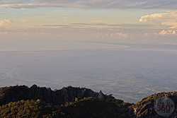
Due to its height and Panama's relatively short width, it is possible to see both the Pacific Ocean and Caribbean Sea from Volcán Barú's peak on a clear day, this is relatively rare.
Description
Volcán Barú is a dormant but potentially active volcano just south of the Continental Divide in western Chiriquí Province.[2] It is surrounded by a fertile area of cool highlands drained by the Chiriquí Viejo and Caldera Rivers. The towns of Volcan and Cerro Punta can be found on its western side, while Boquete is on the eastern flank.
The occasional fall of hail or ice pellets has been reported on the summit, where the minimum temperature can be below 0°C (32°F) and the formation of frost is frequent during the dry season.
The peak of the mountain is host to a large installation of broadcast towers.
Eruption
The last major eruption of the volcano was about 500 AD. There are reports and some evidence of a minor eruption around 1550 AD. However, in 2006, an earthquake swarm occurred underneath the mountain, raising fears that it could erupt sometime in the future with explosive force.
National park
The volcano was declared Volcán Barú National Park in 1976, with an area of 14,325 ha (35,400 acres). It is a part of the Mesoamerican Biological Corridor. Fauna include the Black Guan, Black-and-white Hawk-Eagle, Underwood's water mouse, Volcano Junco, Wrenthrush, and Yellow-thighed Finch.[3] Over 250 species of birds have been identified within the park, and all five species of big cats live here as well. The national park protects a range of habitat, including humid montane forests, low humid montane forests, and montane rainforests.[4]
The park's most popular hiking trail is the Sendero Los Quetzales (Los Quetzales Trail), which connects Boquete with Cerro Punta and wraps around the side of the volcano. The trail takes around 6 hours to hike. There is another trail to the top of the volcano, but this is long, steep and strenuous. You can, however, see both the Pacific Ocean and Caribbean Sea from the summit on a clear day.
Gallery
-

Cloud cover seen from Volcán Barú.
-

Volcán Barú Summit.
-

Pacific Ocean as seen from the Volcán Barú Summit.
-

This is the Caribbean Sea visible from the summit of Volcan Baru. Taken early in the morning before clouds usually obscure the view.
-

Taken from the summit of Volcan Baru. This photo show the antenna and support buildings. Visible in the background is the city of David, Panama.
-

Taken in front of the Cerro Brujo Cafe, you can just make out the cross on the summit of Volcan Baru.
-

Shot less than a few miles from the Pacific Coast of Panama, this shows a rare cloudless view of Volcan Baru.
See also
References
- ↑ "Barú". Global Volcanism Program, Smithsonian Institution. http://www.volcano.si.edu/world/volcano.cfm?vnum=1406-01-.
- ↑ "Volcán Barú: Eruptive History and Volcano-Hazards Assessment". Retrieved 17 March 2011.
- ↑ "Volcan Baru/ Panamá". Osatravel. Retrieved 8 June 2012.
- ↑ "Baru Volcano National Park".
External links
| |||||