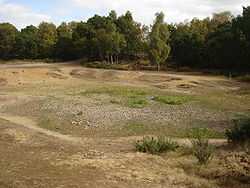
Vinegar Pond


History
Norfolk County Council has made available historic maps covering Norfolk. The vinegar pond is visible on the 1946 aerial photos confirming it was present post World War II. However, in the first edition of the OS map (c1900), the area in question is marked as containing gravel pits.
The pond is believed to have been created in World War II by military manoeuvres involving Bren Gun carriers — their weight compressing the soil and rendering it impervious to water.[2]
Ecology
The pond is a rain fed dew pond and is the only standing water on the heath. It is an important site for breeding frogs and also attracts several species of dragonfly. In the area of gorse adjacent to the pond, there is a colony of the Green Hairstreak butterfly. In the summers of 2006 and 2009 the pond dried up after periods of prolonged drought.
References
External links
Coordinates: 52°38′45″N 1°18′40″E / 52.64583°N 1.31111°E