Verson
From Wikipedia, the free encyclopedia
For other uses, see Verson (disambiguation).
| Verson | ||
|---|---|---|
 | ||
| ||
 Verson | ||
|
Location within Lower Normandy region  Verson | ||
| Coordinates: 49°09′20″N 0°27′03″W / 49.1556°N 0.4508°WCoordinates: 49°09′20″N 0°27′03″W / 49.1556°N 0.4508°W | ||
| Country | France | |
| Region | Lower Normandy | |
| Department | Calvados | |
| Arrondissement | Caen | |
| Canton | Évrecy | |
| Intercommunality | Rives de l'Odon | |
| Government | ||
| • Mayor (2008–2014) | Michel Marie | |
| Area | ||
| • Land1 | 10.36 km2 (4.00 sq mi) | |
| Population (2008) | ||
| • Population2 | 3,621 | |
| • Population2 Density | 350/km2 (910/sq mi) | |
| INSEE/Postal code | 14738 / 14790 | |
| Elevation |
12–93 m (39–305 ft) (avg. 83 m or 272 ft) | |
|
1 French Land Register data, which excludes lakes, ponds, glaciers > 1 km² (0.386 sq mi or 247 acres) and river estuaries. 2 Population without double counting: residents of multiple communes (e.g., students and military personnel) only counted once. | ||

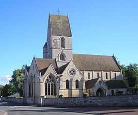
Verson is a commune in the Calvados department in the Basse-Normandie region in northwestern France.
Population
| Historical population | ||
|---|---|---|
| Year | Pop. | ±% |
| 1793 | 1,061 | — |
| 1800 | 1,021 | −3.8% |
| 1806 | 1,347 | +31.9% |
| 1821 | 1,102 | −18.2% |
| 1831 | 1,280 | +16.2% |
| 1836 | 1,285 | +0.4% |
| 1841 | 1,270 | −1.2% |
| 1846 | 1,275 | +0.4% |
| 1851 | 1,167 | −8.5% |
| 1856 | 1,215 | +4.1% |
| 1861 | 1,206 | −0.7% |
| 1866 | 1,171 | −2.9% |
| 1872 | 1,040 | −11.2% |
| 1876 | 1,023 | −1.6% |
| 1881 | 933 | −8.8% |
| 1886 | 895 | −4.1% |
| 1891 | 875 | −2.2% |
| 1896 | 804 | −8.1% |
| 1901 | 801 | −0.4% |
| 1906 | 785 | −2.0% |
| 1911 | 760 | −3.2% |
| 1921 | 734 | −3.4% |
| 1926 | 694 | −5.4% |
| 1931 | 715 | +3.0% |
| 1936 | 722 | +1.0% |
| 1946 | 899 | +24.5% |
| 1954 | 1,002 | +11.5% |
| 1962 | 1,335 | +33.2% |
| 1968 | 1,380 | +3.4% |
| 1975 | 1,743 | +26.3% |
| 1982 | 2,215 | +27.1% |
| 1990 | 3,153 | +42.3% |
| 1999 | 3,580 | +13.5% |
| 2008 | 3,621 | +1.1% |
See also
References
| Wikimedia Commons has media related to Verson. |
This article is issued from Wikipedia. The text is available under the Creative Commons Attribution/Share Alike; additional terms may apply for the media files.