Veldhoven
| Veldhoven | |||
|---|---|---|---|
| Municipality | |||
 | |||
| |||
 | |||
| Coordinates: 51°25′N 05°24′E / 51.417°N 5.400°ECoordinates: 51°25′N 05°24′E / 51.417°N 5.400°E | |||
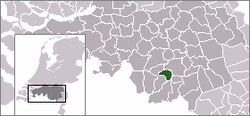
| Country | Netherlands | ||
| Province | North Brabant | ||
| Area(2006) | |||
| • Total | 31.92 km2 (12.32 sq mi) | ||
| • Land | 31.72 km2 (12.25 sq mi) | ||
| • Water | 0.20 km2 (0.08 sq mi) | ||
| Population (1 August 2013) | |||
| • Total | 44,186 | ||
| • Density | 1,356/km2 (3,510/sq mi) | ||
| Source: CBS, Statline. | |||
| Time zone | CET (UTC+1) | ||
| • Summer (DST) | CEST (UTC+2) | ||

Veldhoven (Dutch pronunciation: [ˈvɛɫt.ˌɦoː.və(n)] (![]() )) is a municipality and a town on the Gender stream in the southern Netherlands, located just south-west of Eindhoven.
)) is a municipality and a town on the Gender stream in the southern Netherlands, located just south-west of Eindhoven.
Topography
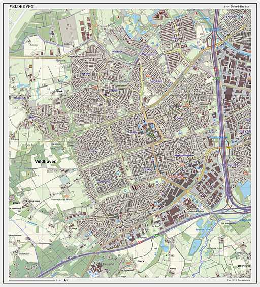
Dutch topographic map of Veldhoven (town), Dec. 2013
Population centres
The modern town of Veldhoven is an agglomeration of formerly rural villages that in the twentieth century grew together to form one large suburban area catering to Eindhoven commuter needs. The villages are Veldhoven proper to the southwest, Meerveldhoven to the southeast, Oerle to the east and Zeelst to the northeast. A new city center was constructed between Zeelst and Veldhoven.
Economy
Veldhoven is home to the headquarters of the manufacturer of high-tech (semiconductor) lithography equipment ASML. ASML occupies the highest building (83 meters) in Veldhoven. The municipality features a large industrial and office area along the Gender, which also includes the second-largest hospital in the Eindhoven urban region, Máxima Medisch Centrum.
Culture
The yearly festival Cult en Tumult offers a varied program of art and culture in the broadest sense. Theatre De Schalm is near the City Centrum.
Transport
Eindhoven Airport is located nearby Veldhoven on the border with Eindhoven in subdivision Meerhoven.
External links
| Wikimedia Commons has media related to Veldhoven. |
 |
Eindhoven | | ||
| Eersel | |
Eindhoven Waalre | ||
| ||||
| | ||||
| Bergeijk |
| |||||||||||
