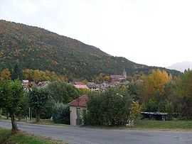
Valserres
From Wikipedia, the free encyclopedia
| Valserres | ||
|---|---|---|
 | ||
| ||
 Valserres | ||
|
Location within Provence-A.-C.d'A. region  Valserres | ||
| Coordinates: 44°29′23″N 6°07′40″E / 44.4897°N 6.1278°ECoordinates: 44°29′23″N 6°07′40″E / 44.4897°N 6.1278°E | ||
| Country | France | |
| Region | Provence-Alpes-Côte d'Azur | |
| Department | Hautes-Alpes | |
| Arrondissement | Gap | |
| Canton | La Bâtie-Neuve | |
| Intercommunality | Avance | |
| Government | ||
| • Mayor (2008–2014) | Yves Jaussaud | |
| Area | ||
| • Land1 | 11.92 km2 (4.60 sq mi) | |
| Population (2008) | ||
| • Population2 | 217 | |
| • Population2 Density | 18/km2 (47/sq mi) | |
| INSEE/Postal code | 05176 / 05130 | |
| Elevation |
608–1,410 m (1,995–4,626 ft) (avg. 662 m or 2,172 ft) | |
|
1 French Land Register data, which excludes lakes, ponds, glaciers > 1 km² (0.386 sq mi or 247 acres) and river estuaries. 2 Population without double counting: residents of multiple communes (e.g., students and military personnel) only counted once. | ||

Valserres is a commune in the Hautes-Alpes department in southeastern France.
Population
| Historical population | ||
|---|---|---|
| Year | Pop. | ±% |
| 1962 | 197 | — |
| 1968 | 212 | +7.6% |
| 1975 | 149 | −29.7% |
| 1982 | 148 | −0.7% |
| 1990 | 164 | +10.8% |
| 1999 | 192 | +17.1% |
| 2008 | 217 | +13.0% |
See also
References
| Wikimedia Commons has media related to Valserres. |
This article is issued from Wikipedia. The text is available under the Creative Commons Attribution/Share Alike; additional terms may apply for the media files.