Valiyavila
From Wikipedia, the free encyclopedia
| Valiyavila | |
|---|---|
| village | |
 Valiyavila | |
| Coordinates: 8°30′25″N 76°59′54″E / 8.50694°N 76.99833°ECoordinates: 8°30′25″N 76°59′54″E / 8.50694°N 76.99833°E | |
| Country |
|
| State | Kerala |
| District | Thiruvananthapuram |
| Languages | |
| • Official | Malayalam, English |
| Time zone | IST (UTC+5:30) |
| PIN | 695006 |
| Telephone code | 0471 |
| Vehicle registration | KL-01 |
| Nearest city | Thiruvananthapuram |
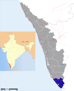
Valiyavila is a locality, situated on the border of Thiruvananthapuram (Trivandrum) city, capital of the Indian state of Kerala.
Geography
It is located at 8°30′25″N 76°59′54″E / 8.50694°N 76.99833°E.
Location
This place is located en route Peyad - Kattakada - Neyyar Dam. It is around 8 km from Thiruvananthapuram Central Railway Station (via Karamana) and around 10 km via Vazhuthacaud, or Sasthamangalam and about 6 km via Karamana.[citation needed] Valiyavila is well connected by bus services from both East Fort and Thampanoor bus stations in Thiruvananthapuram city.
Kundamankadavu Bridge, which crosses the Karamana River is located near Valiyavila. The bridge is more than 100 years old.[1]
References
- ↑ Kundamankadavu Bridge http://www.hindu.com/2008/08/16/stories/2008081661540300.htm
External links
| ||||||||||||||||||||||||||||||||||||||||||||||
This article is issued from Wikipedia. The text is available under the Creative Commons Attribution/Share Alike; additional terms may apply for the media files.
