Union County, New Jersey
| Union County, New Jersey | ||
|---|---|---|
 Downtown Westfield | ||
| ||
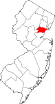 Location in the state of New Jersey | ||
 New Jersey's location in the U.S. | ||
| Founded | 1857[1] | |
| Seat | Elizabeth[2] | |
| Largest city | Elizabeth (population and area) | |
| Area | ||
| • Total | 105.40 sq mi (273 km2) | |
| • Land | 102.86 sq mi (266 km2) | |
| • Water | 2.55 sq mi (7 km2), 2.42% | |
| Population | ||
| • (2010) | 536,499[3] | |
| • Density | 5,058/sq mi (1,953/km²) | |
| Congressional districts | 6th, 7th, 10th, 13th | |
| Website | www.ucnj.org | |

Union County is a county located in the U.S. state of New Jersey. At the 2010 United States Census, the population was 536,499, an increase of 13,958 (2.7%) from the 522,541 enumerated in the 2000 Census, making it the seventh-most populous county in the state, having been surpassed by Ocean County.[4][5] It is part of the New York metropolitan area. Its county seat is Elizabeth.[6][2] The Bureau of Economic Analysis ranked the county as having the 119th-highest per capita income of all 3,113 counties in the United States (and the eighth-highest in New Jersey) in 2009.[7] A study by Forbes.com determined that Union County pays the second-highest property taxes of all U.S. counties, based on 2007 data.[8] With a population density of 4,955 people per square mile (water excluded), Union County was the 15th-most densely populated county in America as of the 2010 Census, and third-densest in New Jersey, behind Hudson County (ranked 6th at 9,754) and Essex County (ranked 11th at 6,126).[9][10]
Union County was formed on March 19, 1857, from portions of Essex County.[1]
Geography
According to the 2010 Census, the county had a total area of 105.40 square miles (273.0 km2), of which 102.86 square miles (266.4 km2) of it (97.6%) was land and 2.55 square miles (6.6 km2) of it (2.4%) was water.[5][11]
Much of Union County is relatively flat and low-lying. Only in the northwestern corner does any significant relief appear as the Watchung Mountains cross the county. It is there that highest elevations, two areas approximately 560 feet (170 m) above sea level, are found in Berkeley Heights.[12] The lowest elevation is sea level along the eastern shore.
Adjacent counties
- Essex County, New Jersey – north
- Hudson County, New Jersey – east
- Richmond County, New York – east
- Middlesex County, New Jersey – south
- Somerset County, New Jersey – west
- Morris County, New Jersey - northwest
Demographics
| Historical population | |||
|---|---|---|---|
| Census | Pop. | %± | |
| 1860 | 27,780 | ||
| 1870 | 41,859 | 50.7% | |
| 1880 | 55,571 | 32.8% | |
| 1890 | 72,467 | 30.4% | |
| 1900 | 99,353 | 37.1% | |
| 1910 | 140,197 | 41.1% | |
| 1920 | 200,157 | 42.8% | |
| 1930 | 305,209 | 52.5% | |
| 1940 | 328,344 | 7.6% | |
| 1950 | 398,138 | 21.3% | |
| 1960 | 504,255 | 26.7% | |
| 1970 | 543,116 | 7.7% | |
| 1980 | 504,094 | −7.2% | |
| 1990 | 493,819 | −2.0% | |
| 2000 | 522,541 | 5.8% | |
| 2010 | 536,499 | 2.7% | |
| Est. 2012 | 543,976 | [13][14] | 1.4% |
| Historical sources: 1790-1990[15] 1970-2010[5] 2000[16] 2010[3] 2000-2010[17] | |||
Union County is diverse ethnically. Berkeley Heights, Clark, Cranford, Kenilworth, Linden, New Providence, Scotch Plains, Springfield, Summit, Union and Westfield have high percentages of Italian American residents. Elizabeth, Linden, Plainfield, Rahway, Roselle and Union Township all have large African American communities. Roselle Park has a notably large Indian American community, while Roselle Park, Linden, Rahway, Plainfield and particularly Elizabeth have fast-growing Hispanic and Portuguese populations. There are Jewish-American communities in Cranford, Elizabeth, Hillside, Springfield, Summit and Westfield.[citation needed]
Census 2010
At the 2010 United States Census, there were 536,499 people, 188,118 households, and 134,692 families residing in the county. The population density was 5,216.1 per square mile (2,013.9 /km2). There were 199,489 housing units at an average density of 1,939.5 per square mile (748.8 /km2). The racial makeup of the county was 61.33% (329,052) White, 22.05% (118,313) Black or African American, 0.39% (2,080) Native American, 4.63% (24,839) Asian, 0.03% (163) Pacific Islander, 8.48% (45,496) from other races, and 3.09% (16,556) from two or more races. Hispanic or Latino of any race were 27.34% (146,704) of the population.[3]
There were 188,118 households of which 34.4% had children under the age of 18 living with them, 50.1% were married couples living together, 15.6% had a female householder with no husband present, and 28.4% were non-families. 23.6% of all households were made up of individuals and 9.7% had someone living alone who was 65 years of age or older. The average household size was 2.82 and the average family size was 3.32.[3]
In the county, 24.5% of the population were under the age of 18, 8.6% from 18 to 24, 27.5% from 25 to 44, 26.8% from 45 to 64, and 12.6% who were 65 years of age or older. The median age was 38 years. For every 100 females there were 94 males. For every 100 females age 18 and over, there were 90.7 males.[3]
Census 2000
At the 2000 United States Census,[18] there were 522,541 people, 186,124 households and 133,264 families residing in the county. The population density was 5,059 per square mile (1,953/km²). There were 192,945 housing units at an average density of 1,868 per square mile (721/km²). The racial makeup of the county was 65.51% White, 20.78% Black or African American, 0.23% Native American, 3.83% Asian, 0.04% Pacific Islander, 6.37% from other races, and 3.25% from two or more races. 19.71% of the population were Hispanic or Latino of any race.[16][19] Among those residents listing their ancestry, 13.6% were of Italian, 11.1% Irish, 8.8% German and 7.6% Polish ancestry according to Census 2000.[20]
There were 186,124 households of which 34.00% had children under the age of 18 living with them, 52.60% were married couples living together, 14.20% had a female householder with no husband present, and 28.40% were non-families. 23.60% of all households were made up of individuals and 10.20% had someone living alone who was 65 years of age or older. The average household size was 2.77 and the average family size was 3.28.[16]
24.90% of the population were under the age of 18, 7.90% from 18 to 24, 31.30% from 25 to 44, 22.10% from 45 to 64, and 13.80% who were 65 years of age or older. The median age was 37 years. For every 100 females there were 92.70 males. For every 100 females age 18 and over, there were 88.90 males.[16]
The median household income was $55,339 and the median family income was $65,234. Males had a median income of $44,544 compared with $32,487 for females. The per capita income for the county was $26,992. About 6.3% of families and 8.4% of the population were below the poverty line, including 10.5% of those under age 18 and 8.0% of those age 65 or over.[21]
Government

Union County is governed by a nine-member Board of Chosen Freeholders. The members are elected at large to serve three-year terms on a staggered basis, with three seats coming up for election each year.[22] The Freeholder Board sets policies for the operation of the County. Actual day-to-day operation of departments is supervised by an appointed County Manager, Alfred Faella.
The Freeholders perform the county's legislative and executive functions. In their legislative role, they formulate and adopt a budget and set county policies and procedures. In their executive role, they oversee county spending and functioning. Many of the administrative duties are delegated by the Board of Chosen Freeholders to the County Manager.
Each of the freeholders serves on various committees and boards as a part of their duties. These include committees on Economic Development, Parks and Recreation, and Public Works and Policy. In addition, the Board oversees the county's Open Space Trust Fund.
Since the January 2014 reorganization, Union County's Freeholders are:[22][23][24][25]
- Freeholder Chairwoman Christopher Hudak (D, Linden, 2014)[26]
- Freeholder Vice Chairman Mohamed S. Jalloh (D, Roselle, 2015)[27]
- Bruce Bergen (D, Springfield, 2015)[28]
- Linda Carter (D, Plainfield, 2016)[29]
- Angel G. Estrada (D, Elizabeth, 2014)[30]
- Sergio Granados (D, Elizabeth, 2016)[31]
- Bette Jane Kowalski (D, Cranford, 2016)[32]
- Alexander Mirabella (D, Fanwood, 2015)[33]
- Vernell Wright (D, Vauxhall in Union, 2014)[34]
Constitutional officers include County clerk Joanne Rajoppi (D, Union, 2015),[35] Sheriff Ralph Froehlich (D, Union, 2016),[36] and Surrogate James S. Lacorte (D, Springfield Township, 2014).[37][38]
Law enforcement at the county level includes the Union County Police Department, the Union County Sheriff's Office, and the Union County Prosecutor's Office.
Union County has the only county seal in the USA that depicts a woman being shot, the murder of Elizabethtown’s Hannah Caldwell by British soldiers during the American Revolutionary War.[39][40]
Four federal Congressional Districts cover the county, including portions of the 7th, 8th, 10th and 12th Districts.[41][42] New Jersey's Seventh Congressional District is represented by Leonard Lance (R, Clinton Township).[43] New Jersey's Eighth Congressional District is represented by Albio Sires (D, West New York).[44] New Jersey's Tenth Congressional District is represented by Donald Payne, Jr. (D, Newark).[45] New Jersey's Twelfth Congressional District is represented by Rush D. Holt, Jr. (D, Hopewell Township).[46]
The county is part of the 20th, 21st and 22nd Districts in the New Jersey Legislature.[47]
Politics
On March 23, 2011, there were a total of 286,071 registered voters in Union County, of whom 119,520 (41.8%) were registered as Democrats, 43,643 (15.3%) were registered as Republicans and 122,799 (42.9%) were registered as Unaffiliated. There were 109 voters registered to other parties.[48] Among the county's 2010 Census population, 53.3% were registered to vote, including 70.6% of those ages 18 and over.[48][49]
In the 2012 presidential election, Democrat Barack Obama received 139,752 votes here (66.0%), ahead of Republican Mitt Romney with 68,314 votes (32.3%) and other candidates with 1,765 votes (0.8%), among the 211,597 ballots cast by the county's 307,628 registered voters, for a turnout of 68.8%.[50][51] In the 2008 presidential election, Democrat Barack Obama received 141,417 votes here (63.1%), ahead of Republican John McCain with 78,768 votes (35.2%) and other candidates with 1,912 votes (0.9%), among the 223,951 ballots cast by the county's 299,762 registered voters, for a turnout of 74.7%.[52] In the 2004 presidential election, Democrat John Kerry received 119,372 votes here (58.3%), ahead of Republican George W. Bush with 82,517 votes (40.3%) and other candidates with 1,498 votes (0.7%), among the 204,759 ballots cast by the county's 283,270 registered voters, for a turnout of 72.3%.[53]
In the 2009 gubernatorial election, Democrat Jon Corzine received 68,867 ballots cast (50.6%), ahead of Republican Chris Christie with 56,769 votes (41.7%), Independent Chris Daggett with 7,999 votes (5.9%) and other candidates with 1,058 votes (0.8%), among the 136,110 ballots cast by the county's 292,490 registered voters, yielding a 46.5% turnout.[54]
Sheriff's office
The Union County Sheriff's Office is located in Elizabeth, New Jersey.
It is headed by Ralph Froehlich, a Union resident who was first elected in 1977 and is the longest-serving sheriff in New Jersey history.[55]
Froehlich hired three top deputies, known as undersheriffs, Joseph P. Cryan, Vincent N. DeTrolio, and Gerald B. Green, Jr.
A 1981 investigation of the Union County Jail reviewed issues relating to overcrowding, escapes, escape attempts and suicides in the detention facility.[56]
Union County Police
Union county is one of a limited number of US counties with a county police department called the Union County Police Department, which operates independently of the Sheriff's office.[57]
Education
Kean University, a co-educational, public research university dating back to 1855 is located in Union and Hillside, serving nearly 13,000 undergraduates. Kean University educates its students in the liberal arts, the sciences and the professions; it is best known for its programs in the humanities and social sciences and in education, graduating the most teachers in the state of New Jersey annually, along with a physical therapy program which it holds in conjunction with the University of Medicine and Dentistry of New Jersey.[58]
Union County College is the two-year community college for Union County, one of a network of 19 county colleges in New Jersey. Union County College was founded in 1933 and has campuses in Cranford, Elizabeth, Plainfield and Scotch Plains.[59]
Economy
The top employers in 2011, according to the Union County Economic Development Corporation, were:[60]
| # | Employer | # of employees |
|---|---|---|
| 1 | Merck & Co. | 10,000 |
| 2 | New England Motor Freight | 3,900 |
| 3 | USI Services Group | 3,200 |
| 4 | Overlook Medical Center | 2,961 |
| 5 | Maher Terminals | 1,700 |
| 6 | Trinitas Hospital | 1,674 |
| 7 | Children’s Specialized Hospital | 1,440 |
| 8 | Alcatel-Lucent | 1,300 |
| 9 | ConocoPhillips | 1,000 |
Transportation
The county is served by rail, air, highways and ports.
Major highways which traverse the county include the New Jersey Turnpike (I-95), Garden State Parkway, I-78, I-278, U.S. Route 1, U.S. Route 9, U.S. Route 22 and the Goethals Bridge.
Passenger rail service is provide by New Jersey Transit via the Northeast Corridor, North Jersey Coast Line, Raritan Valley Line, the Morristown Line and the Gladstone Branch.[61][62][63][64][65] Freight service is provided by on Conrail's Lehigh Line and Chemical Coast Branch. Freight and passenger rail service was provided by the Rahway Valley Railroad from 1897 until 1992 when the short line closed due to lack of customers.
NJ Transit provides bus service to the Port Authority Bus Terminal in Midtown Manhattan, as well as service to major cities in New Jersey and within Union County.[66]
The Port Newark-Elizabeth Marine Terminal is part of the Port Authority of New York and New Jersey.[67]
The southern portion of Newark Airport is located in Elizabeth, within Union County.[68]
Municipalities

Boroughs
- Fanwood (6)
- Garwood (5)
- Kenilworth (8)
- Mountainside (3)
- New Providence (2)
- Roselle Park (9)
- Roselle (10)
Cities
- Elizabeth (11)
- Linden (12)
- Plainfield (7)
- Rahway (13)
- Summit (1)
Towns
- Westfield (4)
Townships
- Berkeley Heights (21)
- Clark (14)
- Cranford (16)
- Hillside (19)
- Scotch Plains (20)
- Springfield (17)
- Union (18)
- Winfield (15)
Parks


- Ash Brook Reservation
- Black Brook Park
- Briant Park
- Brookside Park
- Cedar Brook Park
- Echo Lake Park
- Elizabeth River Park
- Green Brook Park
- Hidden Valley Park
- Lenape Park
- Madison Aenue Park
- Mattano Park
- McConnell Park
- Milton Lake Park
- Nomahagen Park
- Oak Ridge Park
- Passaic River Park
- Phil Rizzuto Park
- Ponderosa Farm Park
- Rahway River Park
- Rahway River Parkway
- Tamaques Park
- Unami Park
- Warinanco Park
Other recreational facilities
- Ash Brook Golf Course
- Galloping Hill Golf Course
- Oak Ridge Archery Range
- Trailside Nature and Science Center
- Warinanco Ice Skating Rink
- Watchung Reservation

Wheeler Park County Pool - Wheeler Park (Linden) County Pool - Rahway River Park (Rahway)
Climate and weather
| Elizabeth, New Jersey | ||||||||||||||||||||||||||||||||||||||||||||||||||||||||||||
|---|---|---|---|---|---|---|---|---|---|---|---|---|---|---|---|---|---|---|---|---|---|---|---|---|---|---|---|---|---|---|---|---|---|---|---|---|---|---|---|---|---|---|---|---|---|---|---|---|---|---|---|---|---|---|---|---|---|---|---|---|
| Climate chart (explanation) | ||||||||||||||||||||||||||||||||||||||||||||||||||||||||||||
| ||||||||||||||||||||||||||||||||||||||||||||||||||||||||||||
| ||||||||||||||||||||||||||||||||||||||||||||||||||||||||||||
In recent years, average temperatures in the county seat of Elizabeth have ranged from a low of 24 °F (−4 °C) in January to a high of 86 °F (30 °C) in July, although a record low of −14 °F (−26 °C) was recorded in February 1934 and a record high of 105 °F (41 °C) was recorded in July 1993. Average monthly precipitation ranged from 2.99 inches (76 mm) in February to 4.76 inches (121 mm) in July.[69]
See also
References
- ↑ 1.0 1.1 Snyder, John P. The Story of New Jersey's Civil Boundaries: 1606-1968, Bureau of Geology and Topography; Trenton, New Jersey; 1969. p. 237. Accessed January 21, 2013.
- ↑ 2.0 2.1 Union County, NJ, National Association of Counties. Accessed January 21, 2013.
- ↑ 3.0 3.1 3.2 3.3 3.4 DP1 - Profile of General Population and Housing Characteristics: 2010 Demographic Profile Data for Union County, New Jersey, United States Census Bureau. Accessed September 30, 2013.
- ↑ NJ Labor Market Views, New Jersey Department of Labor and Workforce Development, March 15, 2011. Accessed October 6, 2013.
- ↑ 5.0 5.1 5.2 New Jersey: 2010 - Population and Housing Unit Counts; 2010 Census of Population and Housing, p. 6, CPH-2-32. United States Census Bureau, August 2012, backed up by the Internet Archive as of July 31, 2013. Accessed October 6, 2013.
- ↑ "Find a County". National Association of Counties. Retrieved 2011-06-07.
- ↑ 250 Highest Per Capita Personal Incomes of the 3113 Counties in the United States, 2009, Bureau of Economic Analysis. Accessed April 9, 2012.
- ↑ Woolsey, Matt. "In Depth: Who Pays America's Highest Property Taxes? 2. Union County, N.J.", Forbes, January 23, 2009. Accessed October 2, 2013.
- ↑ "Census 2000 Data Rankings; A data rankings document focused on the Roanoke Valley and Alleghany Highlands region", Roanoke Valley-Alleghany Regional Commission, p. 22. Accessed October 6, 2013.
- ↑ Staff. "Census 2010 data show population and diversity trends", USA Today. Accessed October 2, 2013. Click on "Population per Square Mile" to sort counties nationwide by descending population density, which was calculated based on total land area (including water) and lists Union as 18th and Essex as 14th.
- ↑ Census 2010 U.S. Gazetteer Files: New Jersey Counties, United States Census Bureau, Backed up by the Internet Archive as of June 11, 2012. Accessed October 6, 2013.
- ↑ New Jersey County High Points, Peakbagger.com. Accessed October 5, 2013.
- ↑ PEPANNRES: Annual Estimates of the Resident Population: April 1, 2010 to July 1, 2012 - 2012 Population Estimates for New Jersey, United States Census Bureau. Accessed March 14, 2013.
- ↑ State & County QuickFacts for Union County, New Jersey, United States Census Bureau. Accessed March 14, 2013.
- ↑ Forstall, Richard L. Population of states and counties of the United States: 1790 to 1990 from the Twenty-one Decennial Censuses, pp. 108-109. United States Census Bureau, March 1996. ISBN 9780934213486. Accessed October 6, 2013.
- ↑ 16.0 16.1 16.2 16.3 DP-1 - Profile of General Demographic Characteristics: 2000; Census 2000 Summary File 1 (SF 1) 100-Percent Data for Union County, New Jersey, United States Census Bureau. Accessed September 30, 2013.
- ↑ U.S. Census Bureau Delivers New Jersey's 2010 Census Population Totals, United States Census Bureau, February 3, 2011. Accessed February 5, 2011.
- ↑ "American FactFinder". United States Census Bureau. Retrieved 2008-01-31.
- ↑ Tables DP-1 to DP-4 from Census 2000 for Union County, New Jersey, United States Census Bureau, backed up by the Internet Archive as of July 4, 2008. Accessed October 2, 2013.
- ↑ DP-2 - Profile of Selected Social Characteristics: 2000 from the Census 2000 Summary File 3 (SF 3) - Sample Data for Union County, New Jersey, United States Census Bureau. Accessed September 30, 2013.
- ↑ DP-3 - Profile of Selected Economic Characteristics: 2000 from Census 2000 Summary File 3 (SF 3) - Sample Data for Union County, New Jersey, United States Census Bureau. Accessed September 30, 2013.
- ↑ 22.0 22.1 Board of Chosen Freeholders, Union County, New Jersey. Accessed January 26, 2014.
- ↑ Union County 2013 General/School Election November 5, 2013, Union County, New Jersey. Accessed January 26, 2014.
- ↑ Union County 2012 General/School Election - November 6, 2012, Union County, New Jersey. Accessed January 26, 2014.
- ↑ Union County 2011 General Election - November 8, 2011, Union County, New Jersey. Accessed January 26, 2014.
- ↑ Freeholder Vice Chairman Christopher Hudak, Union County, New Jersey. Accessed January 26, 2014.
- ↑ Freeholder Mohamed S. Jalloh, Union County, New Jersey. Accessed January 26, 2014.
- ↑ Freeholder Bruce Bergen, Union County, New Jersey. Accessed January 26, 2014.
- ↑ Freeholder Chairman Linda Carter, Union County, New Jersey. Accessed January 26, 2014.
- ↑ Freeholder Angel G. Estrada, Union County, New Jersey. Accessed January 26, 2014.
- ↑ Freeholder Sergio Granados, Union County, New Jersey. Accessed January 26, 2014.
- ↑ Freeholder Bette Jane Kowalski, Union County, New Jersey. Accessed January 26, 2014.
- ↑ Freeholder Alexander Mirabella, Union County, New Jersey. Accessed January 26, 2014.
- ↑ Freeholder Vernell Wright, Union County, New Jersey. Accessed January 26, 2014.
- ↑ County Clerk, Union County, New Jersey. Accessed January 26, 2014.
- ↑ Office of the Union County Sheriff, Union County, New Jersey. Accessed January 26, 2014.
- ↑ Surrogate, Union County, New Jersey. Accessed January 26, 2014.
- ↑ Elected Officials – Clerk – Sheriff – Surrogate, Union County, New Jersey. Accessed January 26, 2014.
- ↑ Union County officials battle activist over use of controversial county seal July 10, 2011.
- ↑ Seal of Union County, NJ
- ↑ 2012 Congressional Districts by County, New Jersey Department of State Division of Elections. Accessed October 2, 2013.
- ↑ Plan Components Report, New Jersey Department of State Division of Elections, December 23, 2011. Accessed October 2, 2013.
- ↑ Directory of Representatives: New Jersey, United States House of Representatives. Accessed January 5, 2012.
- ↑ Directory of Representatives: New Jersey, United States House of Representatives. Accessed January 5, 2012.
- ↑ Directory of Representatives: New Jersey, United States House of Representatives. Accessed January 5, 2012.
- ↑ Directory of Representatives: New Jersey, United States House of Representatives. Accessed January 5, 2012.
- ↑ 2011 Legislative Districts by County, New Jersey Department of State Division of Elections. Accessed October 6, 2013.
- ↑ 48.0 48.1 Voter Registration Summary - Union, New Jersey Department of State Division of Elections, March 23, 2011. Accessed May 26, 2013.
- ↑ GCT-P7: Selected Age Groups: 2010 - State -- County Subdivision; 2010 Census Summary File 1 for New Jersey, United States Census Bureau. Accessed May 26, 2013.
- ↑ Presidential November 6, 2012 General Election Results - Union County, New Jersey Department of State Division of Elections, March 15, 2013. Accessed May 26, 2013.
- ↑ Number of Registered Voters and Ballots Cast November 6, 2012 General Election Results - Union County, New Jersey Department of State Division of Elections, March 15, 2013. Accessed May 26, 2013.
- ↑ 2008 Presidential General Election Results: Union County, New Jersey Department of State Division of Elections, December 23, 2008. Accessed May 26, 2013.
- ↑ 2004 Presidential Election: Union County, New Jersey Department of State Division of Elections, December 13, 2004. Accessed May 26, 2013.
- ↑ 2009 Governor: Union County, New Jersey Department of State Division of Elections, December 31, 2009. Accessed May 26, 2013.
- ↑ Union County Sheriff Ralph Froehlich, Union County, New Jersey. Accessed October 2, 2013. "Ralph Froehlich, a Union resident, was first elected Sheriff of Union County in 1977 and is currently in his 12th term. He is the longest-serving County Sheriff in New Jersey history."
- ↑ Parisi, Albert J. "Suicide Sparks Union County Jail Inquiry", The New York Times, August 23, 1981. Accessed October 2, 2013.
- ↑ Union County Police Department, Union County, New Jersey. Accessed October 2, 2013.
- ↑ Kean University, U.S. News & World Report. Accessed October 2, 2013.
- ↑ General Information, Union County College. Accessed October 2, 2013.
- ↑ "Major Employers Report for Union County, NJ". Union County, New Jersey. Union County Economical Development Corporation. Retrieved 28 October 2013.
- ↑ Gladstone Branch, New Jersey Transit. Accessed October 6, 2013.
- ↑ Morristown Line, New Jersey Transit. Accessed October 6, 2013.
- ↑ Northeast Corridor, New Jersey Transit. Accessed October 6, 2013.
- ↑ North Jersey Coast Line, New Jersey Transit. Accessed October 6, 2013.
- ↑ Raritan Valley Line, New Jersey Transit. Accessed October 6, 2013.
- ↑ Union County Bus / Rail Connections, New Jersey Transit, backed up by the Internet Archive as of May 22, 2009. Accessed October 6, 2013.
- ↑ About the Port, Port Authority of New York and New Jersey. Accessed October 6, 2013.
- ↑ About the Airport, Newark Airport. Accessed October 6, 2013.
- ↑ 69.0 69.1 "Monthly Averages for Elizabeth, New Jersey". The Weather Channel. Retrieved 2012-10-13.
External links
| |||||||||||||||||||||||
| ||||||||||||||||||||||

Coordinates: 40°39′N 74°17′W / 40.65°N 74.29°W