| Historical population |
|---|
| Year |
Pop. | ±% |
|---|
| 1951 |
3,866 | — |
| 1960 |
3,559 | −7.9% |
| 1970 |
3,019 | −15.2% |
| 1980 |
2,774 | −8.1% |
| 1990 |
2,915 | +5.1% |
| 2000 |
2,843 | −2.5% |
| 2007 |
2,753 | −3.2% |
| 2008 |
2,773 | +0.7% |
| 2009 |
2,792 | +0.7% |
| Source: Statistics Norway. |
Tysnes is a municipality in the county of Hordaland, Norway. It is located in the traditional district of Sunnhordland. The administrative centre is the village of Uggdal.
The parish of Tysnæs was established as a municipality on 1 January 1838 (see formannskapsdistrikt). The municipality consists of a group of islands, located south of Bergen where the Hardangerfjord and the coastal archipelago meet. The largest of these islands, named Tysnesøy or just Tysnes, can be reached from the mainland either by ferry to the town of Våge in the north of the island or by the bridge constructed on the eastern side of the island.[citation needed]
General information
The name
The municipality (originally the parish) are named after the Tysnes farm (Old Norse Týsnes), since the first church was built here. The first element is the genitive case of the name of the god Tyr and the last element is nes which means "headland".
This is probably the only place in Norway named after the god Tyr. It is interesting to note that several place names around the farm also have sacred meanings: Ve (holy place), Helgastein (holy rock), Godøy (the god's island), and Vevatnet (the holy lake). The old name of the big island of Tysnesøy was Njarðarlǫg (the district of the god Njord). Recently, a sun phenomenon connected to the original Tysnes headland has been discovered, and this seems to be the starting-point of the sacral name complex.
Coat-of-arms
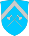
The coat-of-arms is from modern times. They were granted on 28 October 1971. The arms are derived from the seal of the medieval Onarheim guild. Onarheim is a town on Tysnes island, and was formally a Viking Age center of power in Sunnhordland, now part of Tysnes municipality. It is two crossed silver axes on a blue background. The chevron was added to the municipal arms to distinguish it from the medieval arms.[2]
References
External links