Turquino National Park
From Wikipedia, the free encyclopedia
| Turquino National Park | |
|---|---|
|
IUCN category II (national park) | |
 | |
| Location |
|
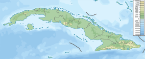
| Nearest city | Guamá |
| Coordinates | 19°59′22″N 76°50′9″W / 19.98944°N 76.83583°WCoordinates: 19°59′22″N 76°50′9″W / 19.98944°N 76.83583°W |
| Area | 229.38 km2 (88.56 sq mi)[1] |
| Established | January 8, 1980[2] |
Turquino National Park (sometimes called Sierra Maestra National Park) is a National Park in Cuba. It is located in the heights of the Sierra Maestra mountain range, in the Santiago de Cuba Province, 50 km (31 mi) west of Guamá.
Overview
The park was named for Pico Turquino (1,975 m (6,480 ft)), the highest point in Cuba and has a total area of 229.38 km2 (88.56 sq mi).[1] It was established on January 8, 1980, with the passing of bill 27/1980.[2] Besides Pico Turquino it also contains the mountains Pico Cuba, Pico Real and Pico Suecia, and the protected area stretches to Cuba's southern coast at the beach of Marea del Portillo.
References
- ↑ 1.0 1.1 National Protected Areas System of Cuba. "Protected Areas". Retrieved 2007-10-10.
- ↑ 2.0 2.1 Radio Habana. "Parque Nacional Sierra Maestra". Archived from the original on 2007-10-04. Retrieved 2007-10-10. (Spanish)
External links
![]() Media related to Turquino National Park at Wikimedia Commons
Media related to Turquino National Park at Wikimedia Commons
| |||||||||||||
This article is issued from Wikipedia. The text is available under the Creative Commons Attribution/Share Alike; additional terms may apply for the media files.