Trpinja
| Trpinja | |||
|---|---|---|---|
| Municipality | |||
| Municipality of Trpinja Općina Trpinja | |||
 | |||
| |||
 Trpinja | |||
 Trpinja | |||
| Coordinates: 45°25′N 18°54′E / 45.417°N 18.900°E | |||
| Country |
| ||
| County | Vukovar-Syrmia | ||
| Government | |||
| • Municipal mayor | Miroslav Palić[1] (Independent Democratic Serb Party[1]) | ||
| Area | |||
| • Total | 123.87 km2 (47.83 sq mi) | ||
| Population (2011) | |||
| • Total | 5,680 | ||
| • Density | 46/km2 (120/sq mi) | ||
| Time zone | CET (UTC+1) | ||
| • Summer (DST) | CEST (UTC+2) | ||
| Postal code | 32224 Trpinja | ||
| Area code(s) | 32 | ||
| Vehicle registration | VU | ||
| Official languages | Croatian, Serbian[2] | ||
| Website | www.trpinja.hr | ||

Trpinja is a village and municipality in the Vukovar-Syrmia County in eastern Croatia.
Languages and names
On the territory of Trpinja municipality, along with Croatian which is officiall in the whole country, as a second official language has been introduced Serbian language and Serbian Cyrillic alphabet.[3][4] In Serbian Cyrillic village is known as Трпиња, and in Hungarian as Terpenye.
Villages Trpinja, Bobota and Vera share common legend about origin of their names. According to legend ancestors of today's inhabitants of villages who settled in Great Serb Migrations under Arsenije III Čarnojević were called Bobe. They were fleeing from Ottoman Empire conquest to preserve their faith. Therefore was formed local phrase which says Bobe suffer for faith or in Serbian Bobe trpiše za veru. From word Bobe was created name Bobota, from word suffer (Serbian:trpiti) was created name Trpinja and from word faith (Serbian:vera) was created name of village Vera.[5]
Another story tells that name Trpinja originated from landowner Trpimir who owned land in the vicinity.[5]
Geography
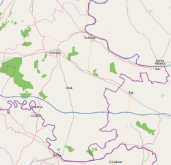
Municipality is located on border between historical regions Slavonia and Syrmia in the southern part of Pannonian Basin in Podunavlje region. Municipality total area is 123.87 km2 (47.8 sq mi).[6] River Vuka flows through the municipality in length of 8 kilometers and also an artificial Bobota Canal in length of 20 kilometers. The territory of the municipality is completely flat very fertile black soil.
Climate and weather
Trpinja municipality has a moderately warm and rainy continental climate as defined by the Köppen climate classification. Due to the influence of continentality temperature differences within one year are more pronounced than in the rest of country.
Transportation
Trpinja is connected by D2 highway with rest of country.
Biome
History
Name of the Trpinja settlement was first mentioned in 1329 in one document issued in the medieval Kingdom of Hungary. Document is today kept in Budapest, Hungary.[5] In fact in this period at the place of present Trpinja were settlements Mala Trpinja, Velika Trpinja and Slavenska Trpinja.[5] Villages was owned by the gentry until it was conquered by the Ottoman Empire in 1536.[5] Ottoman authorities settled Serb population in this area, which resulted in decreased percentage of local Hungarians. Area was under Ottoman administration until 1691, when it was conquered by the Habsburg Monarchy. According to the census of 1732, Trpinja had 109 Serb families. Built of the Serbian Orthodox church began in 1750 and was completed in 1755. The first school in Trpinja was opened in 1776, while in 1859 Trpinja had a factory for spinning silk.[5] In 1882, population of Trpinja numbered about 1,800 people in 400 homes. The inhabitants were Christian Orthodox Serbs, except of 2-3 families of Roman Catholic faith.[5] Although the period of First World War in a village was marked by a disease and poverty, Trpinja residents hosted the population of the village of Jakovo. The villagers participated in the anti-fascist struggle in World War II, and one number of them ended up in concentration camps of Independent State of Croatia.[5] During war, in nine Slavonian Brigade fought 452 soldiers from Trpinja, of which 75 soldiers were killed.[5] 170 Romani people from Trpinja were arrested by Ustaše and taken to Jasenovac concentration camp in 1942, no one of them returned.[5] According to the 1981 census, Trpinja had 2,243 inhabitants.
Demographics
Population
There are 1,537 inhabitants in village Trpinja and 5,680 inhabitants in the municipality according to the 2011 census.[7] The majority of the population are Serbs, making up 89,75% of the population according to the 2011 population census.[8]
Religion
Politics
Multilateral cooperation
Trpinja municipality is one of seven member municipalities of Joint Council of Municipalities, inter-municipal sui generis organization of Serbian community in eastern Croatia.
Municipality government
The municipality assembly is composed of 15 representatives. As of 2013, the member parties/lists are:
Summary of the 19 May 2013 Croatian local elections| Party | Votes | % | Seats | ||||
|---|---|---|---|---|---|---|---|
| Independent Democratic Serb Party | 730 | 28,62 | 5 | ||||
| Candidates list of group of voters-Miroslav Palić | 704 | 27,60 | 5 | ||||
| Candidates list of group of voters-Miroljub Maširević | 605 | 23,72 | 4 | ||||
| Candidates list of group of voters-Miodrag Pejić | 151 | 5,92 | 1 | ||||
| Candidates list of group of voters-Rado Lazić | 125 | 4,90 | 0 | ||||
| Social Democratic Party of Croatia | 125 | 4,90 | 0 | ||||
| Coalition New Serb Party-Our Party | 111 | 4,35 | 0 | ||||
| Invalid/blank votes | 238 | 8,53 | — | ||||
| Total | 2.793 | 100 | — | ||||
| Registered voters/turnout | 5.052 | 55,29 | — | ||||
|
Additional seat for local Croat minority | |||||||
| Candidates list of group of voters-Miroljub Maširević | — | — | 1 | ||||
 | |||||||
| Source: Croatian Bureau of Statistics page 458 and 459 | |||||||
Economy
Trpinja development index is less than 50% of the Croatian average,[9] which classifies them into 10% of the poorest municipalities. Therefore, the municipality is part of the Areas of Special State Concern.[10]
Education


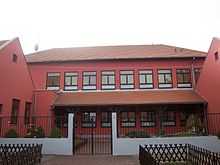
Elementary School in Trpinja is one of the oldest schools in the region. It was established back in 1776.[11] Classes at the school takes place exclusively in the Serbian language (exception are Croatian and foreign languages).[11] Upon completion of eight years of elementary school, students usually continue their education in secondary schools in Vukovar where they could attend classes on Serbian language. The three most-popular universities after high school are University of Novi Sad, University of Osijek and University of Belgrade.
Culture
Points of Interest

Church of the Transfiguration of the Lord in Trpinja was built from 1753 until 1757.[12] The church is a cultural monument and is on the list of immovable cultural heritage of Republic of Croatia. Valuable objects in the church are also on the list of movable cultural heritage of Republic of Croatia. Object is in regular use and is also open for visitors at certain time. Tourist visitors pay no entrance.
At the central site in the Trpinja is set up a monument fallen soldiers from World War II and the fallen soldiers and victims of war in 1991.
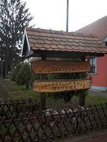
Local cultural society "Mladost" was founded in 1995. Its work preserves and promotes the folk customs and culture of Serbs of Croatian Danube region.
Associations and Institutions
In the village exist a volunteer fire department Trpinja,[13] folk Cultural and Artistic Association "MLADOST", Serbian Cultural Society "Prosvjeta",[14] football club "Sinđelić", chess club "Trpinja",[14] Hunting Association "Srndać" and Hunting Association "Trpinja",[14] Association of subsidiaries of pensioners of Trpinja municipality and Subsidiary of pensioners of Trpinja,[14] "Treća životna dob" ("Third age"), The association of anti-fascist fighters of the National Liberation War and Anti-Fascists of Trpinja municipality.[14]
Settlements
There are seven villages in the municipality.[15]
| Settlement | Population |
|---|---|
| Bobota | 1,540 |
| Bršadin | 1,357 |
| Ćelije | 121 |
| Ludvinci | 113 |
| Pačetin | 548 |
| Trpinja | 1,537 |
| Vera | 458 |
Sport
In 2011 local amateur football club Sinđelić, which is named by Stevan Sinđelić, was a champion of regional Veterans League of Joint Council of Municipalities. In village is also active Chess Club Trpinja.
Notable natives and residents
Twin municipalities – Sister municipalities
See also
- Church of the Transfiguration of the Lord, Trpinja
- Joint Council of Municipalities
- Podunavlje (Croatia)
References
- ↑ 1.0 1.1 "Informacija o rezultatima izbora članova predstavničkih tijela jedinica lokalne i područne (regionalne) samouprave" (PDF). Retrieved 2013-03-10.
- ↑ Četvrto izvješće Republike Hrvatske o primjeni Europske povelje o regionalnim ili manjinskim jezicima, page 61., Zagreb, 2009
- ↑ Izvješće o provođenju ustavnog zakona o pravima nacionalnih manjina i o utošku sredstava osiguranih u državnom proračunu Republike Hrvatske za 2008. godinu za potrebe nacionalnih manjina, Zagreb, 2009.
- ↑ "Registar Geografskih Imena Nacionalnih Manjina Republike Hrvatske" (PDF). Retrieved 2013-03-08.
- ↑ 5.0 5.1 5.2 5.3 5.4 5.5 5.6 5.7 5.8 5.9 http://www.trpinja.hr/index.php?option=com_content&view=article&id=13&Itemid=26&lang=hr
- ↑ "Vukovarsko-srijemska županija-popis općina". Retrieved 2013-03-09.
- ↑ "Census of Population, Households and Dwellings 2011, First Results by Settlements" (PDF). Statistical Reports (in Croatian and English) (Zagreb: Croatian Bureau of Statistics) (1441). June 2011. ISSN 1332-0297. Retrieved 30 June 2011.
- ↑ "Stanovništvo prema narodnostima u VSŽ-Popis 2011-Državni zavod za statistiku". Retrieved 2013-03-08.
- ↑ "0dluka o razvrstavanju jedinica lokalne i podrucne (regionalne) samouprave prema stupnju razvijenosti" (PDF). Retrieved 2013-03-09.
- ↑ "Zakon o područjima od posebne državne skrbi" (PDF). Retrieved 2013-03-09.
- ↑ 11.0 11.1 "Osnovna škola Trpinja-Povijest". Retrieved 2013-03-08.
- ↑ Eparchy of Osječko polje and Baranja http://www.eparhija-osjeckopoljskabaranjska.hr/CMS/0089/Default.aspx?EID=22759
- ↑ Vukovar-Syrmia http://www.vukovarsko-srijemska-zupanija.com/upload/paragrafi_upload/2009-4-17_31616186_prilog9popisvatrogpostrnovi.pdf
- ↑ 14.0 14.1 14.2 14.3 14.4 http://www.trpinja.hr/index.php?option=com_content&view=article&id=35&Itemid=61
- ↑ "Ministarstvo uprave-Podaci o matičnom uredu Trpinja". Retrieved 2013-03-09.
- ↑ "ОДЛУКУ о партнерству и сарадњи између Општине Бачка Паланка и Општине Трпиња из Републике Хрватске" (PDF). Retrieved 2013-03-10.
External links
| Wikimedia Commons has media related to Trpinja. |
| |||||||||||||
| ||||||||||
| ||||||||||||||||||||||||||||||||||||||||||||||||||||||||||
 |
Osijek | Erdut | Erdut |  |
| Šodolovci | |
Borovo, Croatia | ||
| ||||
| | ||||
| Tordinci | Nuštar Bogdanovci |
Vukovar |


