Triefenstein
| Triefenstein | ||
|---|---|---|
| ||
 Triefenstein | ||
Location of Triefenstein within Main-Spessart district 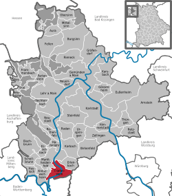 | ||
| Coordinates: 49°48′N 9°36′E / 49.800°N 9.600°ECoordinates: 49°48′N 9°36′E / 49.800°N 9.600°E | ||
| Country | Germany | |
| State | Bavaria | |
| Admin. region | Unterfranken | |
| District | Main-Spessart | |
| Government | ||
| • Mayor | Norbert Endres (CSU) | |
| Area | ||
| • Total | 25.47 km2 (9.83 sq mi) | |
| Elevation | 140-296 m (−831 ft) | |
| Population (2012-12-31)[1] | ||
| • Total | 4,226 | |
| • Density | 170/km2 (430/sq mi) | |
| Time zone | CET/CEST (UTC+1/+2) | |
| Postal codes | 97855 | |
| Dialling codes | 09395 | |
| Vehicle registration | MSP | |
| Website | www.markt-triefenstein.de | |

Triefenstein is a market community in the Main-Spessart district in the Regierungsbezirk of Lower Franconia (Unterfranken) in Bavaria, Germany.
Geography
Location
Triefenstein lies in the Würzburg Region.
The community has the following Gemarkungen (traditional rural cadastral areas): Homburg a.Main, Lengfurt, Rettersheim, Trennfeld.
History
The Triefenstein Monastery (with Rettersheim), founded in 1102, and Trennfeld passed with the 1803 Reichsdeputationshauptschluss to the Counts of Löwenstein-Wertheim, passing again in 1806 to the Principality of Aschaffenburg. The Amt of Homburg in the Princely Electorate (Hochstift) of Würzburg passed for a sum of money to Bavaria, and then in 1805 to the Grand Duchy of Würzburg. Between 1814 and 1816, all current parts of the community passed to Bavaria. In the course of administrative reform in Bavaria, the communities of Rettersheim, Homburg am Main, Lengfurt and Trennfeld came into being with the Gemeindeedikt (“Municipal Edict”) of 1818. These were amalgamated with each other in the course of municipal reform in Bavaria in 1978.
At least since the early 19th century, Jewish families were living in the centre of Homburg, forming a Jewish community and building a synagogue in 1873. Only after Kristallnacht (9 November 1938), indeed, on Christmas Day that year, did SA men burn the house of worship down. At the office building later built on the spot where the synagogue once stood, at Maintalstraße 26, is a memorial plaque recalling this event.[2]
Population development
Within town limits, 3,502 inhabitants were counted in 1970, 3,530 in 1987, 4,201 in 2000 and in 2005 4,720.
Politics
The mayor is Norbert Endres (CSU).
Municipal taxes in 1999 amounted to €2,017,000 (converted), of which net business taxes amounted to €323,000.
Coat of arms
The community’s arms might be described thus: A fess wavy argent, in chief azure a trident erect Or between two roses of the first barbed and seeded of the third, in base gules two keys in saltire, that bendwise of the third surmounting the other of the first.
The two crossed keys come from the arms once borne by the Triefenstein Monastery, founded in 1102 and dissolved in 1803, and recall that the monastery church was consecrated to Saint Peter. Trennfeld’s now disused arms were also chargeed with these keys, and likewise with the trident, which is confirmed by a village seal from 1777. As a guild’s hallmark, it refers to the important Main fishery. The two silver roses come from Lengfurt‘s likewise disused arms. As heraldic emblems of the Counts of Wertheim, they recall the Counts’ lordship over the village until they died out in 1556. The wavy fess (horizontal stripe) symbolizes the community’s geographical location on the river Main. The tinctures argent and gules (silver and red) are those once borne by the Prince-Bishopric (Hochstift) of Würzburg, which maintained an Amt in Homburg, where, it is said, the first Bishop of Würzburg, Burchard died in one of the well known stalactite caves below the castle.
The arms have been borne since 1981.[3]
Economy and infrastructure
According to official statistics, there were 6 workers on the social welfare contribution rolls working in agriculture and forestry in 1998. In producing businesses this was 673, and in trade and transport 95. In other areas, 93 workers on the social welfare contribution rolls were employed, and 1,503 such workers worked from home. There were 2 processing businesses. Six businesses were in construction, and furthermore, in 1999, there were 56 agricultural operations with a working area of 1 100 ha, of which 956 ha was cropland and 105 ha was meadowland.
Education
As of 1999 the following institutions existed in Triefenstein:
- Kindergartens: 200 places with 178 children
- Primary schools: 1 with 14 teachers and 275 pupils
Notes
- ↑ "Fortschreibung des Bevölkerungsstandes". Bayerisches Landesamt für Statistik und Datenverarbeitung (in German). 31 December 2012.
- ↑ Gedenkstätten für die Opfer des Nationalsozialismus. Eine Dokumentation, Band 1. Bundeszentrale für politische Bildung, Bonn 1995, ISBN 3-89331-208-0, S. 195
- ↑ Description and explanation of Triefenstein’s arms
References
- Attribution
- This article incorporates information from the German Wikipedia.
External links
| Wikimedia Commons has media related to Triefenstein. |
- Community’s official webpage (German)
- Triefenstein Monastery (German)
- Ortsteil of Homburg (German)
-
 Chisholm, Hugh, ed. (1911). "Homburg-vor-der-Höhe". Encyclopædia Britannica 13 (11th ed.). Cambridge University Press. p. 625