Treuchtlingen
| Treuchtlingen | ||
|---|---|---|
 | ||
| ||
 Treuchtlingen | ||
Location of Treuchtlingen within Weißenburg-Gunzenhausen district  | ||
| Coordinates: 48°57′19″N 10°54′34″E / 48.95528°N 10.90944°ECoordinates: 48°57′19″N 10°54′34″E / 48.95528°N 10.90944°E | ||
| Country | Germany | |
| State | Bavaria | |
| Admin. region | Mittelfranken | |
| District | Weißenburg-Gunzenhausen | |
| Government | ||
| • Mayor | Werner Baum junior (SPD) | |
| Area | ||
| • Total | 103.00 km2 (39.77 sq mi) | |
| Elevation | 412 m (1,352 ft) | |
| Population (2012-12-31)[1] | ||
| • Total | 12,496 | |
| • Density | 120/km2 (310/sq mi) | |
| Time zone | CET/CEST (UTC+1/+2) | |
| Postal codes | 91757 | |
| Dialling codes | 09142 | |
| Vehicle registration | WUG | |
| Website | Official website | |
Treuchtlingen is a town in the Weißenburg-Gunzenhausen district, in Bavaria, Germany. As of 2011 its population was of 12,778.
History
The spot where the town is situated was first settled by Celt, Romans and Franks. The town proper was founded in 793, during the reign of Charlemagne, and it was first mentioned in 899, as Drutelinga.
Geography
Treuchtlingen is situated on the river Altmühl, 9 km southwest of Weißenburg in Bayern, and 45 km northeast of Donauwörth.
In addition to the town itself, Treuchtlingen includes 53 hamlets and villages. Municipal territory is divided in 12 Ortsteile (including the town) and several hamlets:
| Arms | Ortsteil | Localities included |
|---|---|---|
| |
Treuchtlingen | Eulenhof, Gstadt, Heunischhof, Kästleinsmühle, Metzenhof, Möhrenberg, Sägmühle, Schertnershof, Schmarrmühle, Siebeneichhöfe, Ziegelhütte |
| |
Auernheim | Freihardt, Hagenhof, Schlittenhart, Wieshof |
| |
Bubenheim | none |
| |
Dietfurt | Bergnershof |
| |
Graben | none |
| |
Grönhart | Hagenau, Naßwiesen, Neuheim |
| |
Gundelsheim | none |
| |
Haag | Dickmühle, Hürth, Mattenmühle, Neufang, Rutzenhof, Schürmühle, Steinbruch |
| |
Möhren | Eichhof, Fuchsmühle, Spielhof |
| |
Schambach | Bonhof, Kohlmühle, Lehnleinsmühle, Obere Papiermühle, Untere Papiermühle, Weinbergshof |
| |
Wettelsheim | Dornmühle, Falbenthal, Kellerhaus, Ziegelmühle, Zollmühle |
| |
Windischhausen | Oberheumödern, Unterheumödern |
Personalities
- Gottfried Heinrich Graf zu Pappenheim (1594-1632), field marshal of the Holy Roman Emperor
- Albert Stöckl (1823-1895), priest and theologian
- Elkan Naumburg (1835-1924), German-American banker, philanthropist and musicologist
- Ludwig Fels (b. 1946), writer
International relations
Treuchtlingen is twinned with:
Photogallery
-
Town centre at Ringstraße
-
Town centre at Luitpoldstraße
-

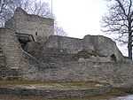
Castle of Treuchtlingen (Obere Veste)
-

Ruins of the castle
-
Train station
-
Old watermill in western suburb
-

Wood nearby Obere Veste
-

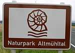
Signboard of Naturpark Altmühltal
Bibliography
- Daniel Burger/Birgit Friedel: Burgen und Schlösser in Mittelfranken; ars vivendi verlag: Cadolzburg 2003; S. 125-128; ISBN 3-89716-379-9.
- Werner Somplatzki: Kirchen in Altmühlfranken; (Reihe Gelbe Taschenbuch-Führer); wek-Verlag: Treuchtlingen 1990; ISBN 978-3-924828-34-9; hier: S. 70-73 u. 76-85.
- Walter E. Keller: Treuchtlingen; (Reihe Gelbe Taschenbuch-Führer); wek-Verlag: Treuchtlingen/Berlin 2006; ISBN 978-3-934145-31-3.
- Walter E. Keller (Hrsg.): Das Dorf Schambach; wek-Verlag: Treuchtlingen 2002; ISBN 978-3-934145-15-3.
- Gotthard Kießling: Landkreis Weißenburg-Gunzenhausen. (Denkmäler in Bayern, V 70/1); Munich 2000; ISBN 3-87490-581-0.
References
- ↑ "Fortschreibung des Bevölkerungsstandes". Bayerisches Landesamt für Statistik und Datenverarbeitung (in German). 31 December 2012.
External links
| Wikimedia Commons has media related to Treuchtlingen. |
- (German) Treuchtlingen official website
- (German) History of Treuctlingen's coat of arms at HdBG
| |||||||


