Trapper Creek Wilderness
| Trapper Creek Wilderness | |
|---|---|
|
IUCN category Ib (wilderness area) | |
 | |
| Location | Skamania County, Washington, USA |
| Nearest city | Stabler, Washington |
| Coordinates | 45°54′14″N 122°01′40″W / 45.90389°N 122.02778°WCoordinates: 45°54′14″N 122°01′40″W / 45.90389°N 122.02778°W |
| Area | 5,970 acres (24.2 km2) |
| Established | 1984 |
| Governing body | U.S. Forest Service |

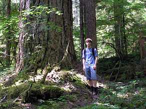
The small Trapper Creek Wilderness area consists of 5,970 acres (24 km2) in southern Washington in the Gifford Pinchot National Forest. The wilderness covers nearly the entire Trapper Creek drainage and is the only pristine anadromous fish habitat in the Wind River watershed.[1] The terrain is very steep and rugged and holds many streams and waterfalls - one as tall as 100 ft (30 m). It is one of the few sizeable blocks of low-elevation old-growth forest remaining in southern Washington. There are many relatively popular and well maintained hiking trails in the wilderness area.
Many animals inhabit this wilderness including the Roosevelt race of elk which can often be found near dry creek in the winter and spring while remaining higher up, close to the ridge trail, just below Observation peak during summer and fall. From the top of Observation peak one can see panaramic views with Mount Hood, Mount Adams, Mount Rainier, Mount Jefferson and the Goat Rocks all in view.
See also
References
- ↑ "Wilderness.net: Trapper Creek Wilderness". Retrieved 2007-12-23.
External links
- "Wilderness.net: Trapper Creek Wilderness: Images". Retrieved 2007-12-23.