Torsac
From Wikipedia, the free encyclopedia
| Torsac | |
|---|---|
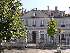 | |
 Torsac | |
|
Location within Poitou-Charentes region  Torsac | |
| Coordinates: 45°33′50″N 0°12′56″E / 45.5639°N 0.2156°ECoordinates: 45°33′50″N 0°12′56″E / 45.5639°N 0.2156°E | |
| Country | France |
| Region | Poitou-Charentes |
| Department | Charente |
| Arrondissement | Angoulême |
| Canton | Villebois-Lavalette |
| Intercommunality | Vallée de l'Échelle |
| Government | |
| • Mayor (2008–2014) | Catherine Bréard |
| Area | |
| • Land1 | 28.55 km2 (11.02 sq mi) |
| Population (2008) | |
| • Population2 | 770 |
| • Population2 Density | 27/km2 (70/sq mi) |
| INSEE/Postal code | 16382 / 16410 |
| Elevation |
73–175 m (240–574 ft) (avg. 40 m or 130 ft) |
|
1 French Land Register data, which excludes lakes, ponds, glaciers > 1 km² (0.386 sq mi or 247 acres) and river estuaries. 2 Population without double counting: residents of multiple communes (e.g., students and military personnel) only counted once. | |
Torsac is a commune in the Charente department in southwestern France.
Population
| Historical population | ||
|---|---|---|
| Year | Pop. | ±% |
| 1793 | 812 | — |
| 1800 | 577 | −28.9% |
| 1806 | 822 | +42.5% |
| 1821 | 905 | +10.1% |
| 1831 | 878 | −3.0% |
| 1841 | 852 | −3.0% |
| 1846 | 837 | −1.8% |
| 1851 | 870 | +3.9% |
| 1856 | 846 | −2.8% |
| 1861 | 795 | −6.0% |
| 1866 | 751 | −5.5% |
| 1872 | 695 | −7.5% |
| 1876 | 646 | −7.1% |
| 1881 | 625 | −3.3% |
| 1886 | 637 | +1.9% |
| 1891 | 564 | −11.5% |
| 1896 | 525 | −6.9% |
| 1901 | 470 | −10.5% |
| 1906 | 480 | +2.1% |
| 1911 | 505 | +5.2% |
| 1921 | 434 | −14.1% |
| 1926 | 441 | +1.6% |
| 1931 | 433 | −1.8% |
| 1936 | 413 | −4.6% |
| 1946 | 386 | −6.5% |
| 1954 | 416 | +7.8% |
| 1962 | 348 | −16.3% |
| 1968 | 352 | +1.1% |
| 1975 | 385 | +9.4% |
| 1982 | 464 | +20.5% |
| 1990 | 731 | +57.5% |
| 1999 | 717 | −1.9% |
| 2008 | 770 | +7.4% |
See also
References
| Wikimedia Commons has media related to Torsac. |
This article is issued from Wikipedia. The text is available under the Creative Commons Attribution/Share Alike; additional terms may apply for the media files.