Torcy, Seine-et-Marne
From Wikipedia, the free encyclopedia
| Torcy | |
|---|---|
 | |
| Coordinates: 48°51′01″N 2°39′03″E / 48.8502°N 2.6508°ECoordinates: 48°51′01″N 2°39′03″E / 48.8502°N 2.6508°E | |
| Country | France |
| Region | Île-de-France |
| Department | Seine-et-Marne |
| Arrondissement | Torcy |
| Canton | Torcy |
| Intercommunality | Val-Maubuée |
| Government | |
| • Mayor (2008–2014) | Christian Chapron |
| Area | |
| • Land1 | 6.00 km2 (2.32 sq mi) |
| Population (2006) | |
| • Population2 | 22,458 |
| • Population2 Density | 3,700/km2 (9,700/sq mi) |
| INSEE/Postal code | 77468 / 77200 |
| Elevation | 37–106 m (121–348 ft) |
|
1 French Land Register data, which excludes lakes, ponds, glaciers > 1 km² (0.386 sq mi or 247 acres) and river estuaries. 2 Population without double counting: residents of multiple communes (e.g., students and military personnel) only counted once. | |
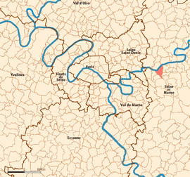
Torcy is a commune in the Seine-et-Marne department in the Île-de-France region in north-central France. It is located in the eastern suburbs of Paris 21.8 km (13.5 mi) from the center.
Torcy is a sub-prefecture of the department and the seat of an arondissement.
The commune of Torcy is part of the Val Maubuée sector, one of the four sectors in the "new town" of Marne-la-Vallée.
Transport
Torcy is served by Torcy station on Paris RER line A.
Demographics
Inhabitants of Torcy are called Torcéens.
See also
References
External links
| Wikimedia Commons has media related to Torcy, Seine-et-Marne. |
- Official site (French)
- 1999 Land Use, from IAURIF (Institute for Urban Planning and Development of the Paris-Île-de-France région) (English)
- French Ministry of Culture list for Torcy (French)
- Map of Torcy on Michelin (English)
| |||||
This article is issued from Wikipedia. The text is available under the Creative Commons Attribution/Share Alike; additional terms may apply for the media files.