Tomahawk, Tasmania
From Wikipedia, the free encyclopedia
| Tomahawk Tasmania | |||||||||||||
|---|---|---|---|---|---|---|---|---|---|---|---|---|---|
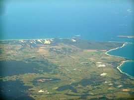
 Tomahawk is just below the lower point on the right | |||||||||||||
 Tomahawk | |||||||||||||
| Coordinates | 40°52′S 147°46′E / 40.867°S 147.767°ECoordinates: 40°52′S 147°46′E / 40.867°S 147.767°E | ||||||||||||
| Population | 111 (2006)[1] | ||||||||||||
| Postcode(s) | 7262 | ||||||||||||
| Location |
| ||||||||||||
| LGA(s) | Dorset Council | ||||||||||||
| State electorate(s) | Bass | ||||||||||||
| Federal Division(s) | Bass | ||||||||||||
| |||||||||||||
Tomahawk is a small seaside town in north east Tasmania, Australia, overlooking the Bass Strait. This small town has a shop with service station and a caravan park. There is a boat ramp and the area is known for its fishing.[citation needed] At the 2006 census, Tomahawk and the surrounding area had a population of 111.[1]
References
- ↑ 1.0 1.1 Australian Bureau of Statistics (25 October 2007). "Tomahawk (State Suburb)". 2006 Census QuickStats. Retrieved 2007-11-17.
This article is issued from Wikipedia. The text is available under the Creative Commons Attribution/Share Alike; additional terms may apply for the media files.