Thma Bang District
From Wikipedia, the free encyclopedia
| Thma Bang ស្រុកថ្មបាំង | |
|---|---|
| District (srok) | |
 Thma Bang | |
| Coordinates: 11°49′N 103°25′E / 11.817°N 103.417°E | |
| Country |
|
| Province | Koh Kong |
| Communes | 6 |
| Villages | 18 |
| Population (1998)[1] | |
| • Total | 2,880 |
| Time zone | +7 |
| Geocode | 0907 |
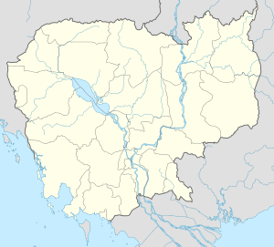
Thmo Bang District (Khmer: ស្រុកថ្មបាំង) is a district (srok) of Koh Kong Province, in south-western Cambodia.
| Thma Bang[2] | ||
| Khum (Commune) | Phum (Villages) | |
|---|---|---|
| Ta Tey Leu | Spean Kdar, Kandal, Trapeang Khnar | |
| Pralay | Chamnar, Pralay, Samraong, Toap Khley, Ta Ngil | |
| Chumnoab | Chumnoab, Chrak Ruessei | |
| Ruessei Chrum | Trapeang Chheu Trav, Kokir Chrum | |
| Chi-Phat | Chi Phat, Tuek L'ao, Chom Sla', Kom Lot | |
| Thmor Donpove | Kaoh, Preaek Svay | |
Notes
- ↑ General Population Census of Cambodia, 1998: Village Gazetteer. National Institute of Statistics. February 2000.
- ↑ Cambodia e-gov "Koh Kong" Accessed June 8, 2008
| |||||||||||||
| ||||||||||
Coordinates: 11°49′N 103°25′E / 11.817°N 103.417°E
This article is issued from Wikipedia. The text is available under the Creative Commons Attribution/Share Alike; additional terms may apply for the media files.
