Thebarton, South Australia

Thebarton (pronounced The-bar-ton) is a suburb of the city of Adelaide, South Australia. The suburb is bounded by the River Torrens to the north, Port Road and Bonython Park to the east, Kintore Street to the south, and South Road to the west.
Many buildings and landmarks that bear the name of Thebarton are actually in the adjoining suburb of Torrensville, including Thebarton Oval, the Thebarton croquet and bowls club, Thebarton Theatre, and Thebarton Senior College.
Thebarton has a significant Greek-Australian population and is the suburb with the largest Greek Australian population per capita in Australia. In fact, according to census data released by the Australian Bureau of Statistics in 2001, the suburbs of Thebarton and neighbouring Torrensville together are home to 4,471 Greek-Australians; i.e., 18.7 per cent of the total population.
History
The suburb of Thebarton was named after the home of Colonel William Light, the first Surveyor-General of the colony of South Australia. Colonel Light named his home after Theberton Hall of Suffolk, England, where he was educated. The variant spelling is accredited to a typographical error. The area was known as Theberton until approximately 1840.
Prior to European settlement, the areas now known as Thebarton and Hindmarsh were called Karraundongga (meaning "reg gum spear place") by the Kaurna people, who would craft spears from the red gum branches gathered on the banks of the Torrens there [Payne, 1996].
Colonel Light surveyed the town-acre as Section 1 and built Theberton Cottage towards the northern part of the area. The area was first subdivided for housing in February 1839, although it took a number of years for the housing to establish, Thebarton Post Office opening on 24 October 1850.[1] By 1866 the population was estimated at around 450 people.
Government
Thebarton is in the City of West Torrens local government area, the South Australian House of Assembly electoral district of West Torrens, and the Australian House of Representatives Division of Adelaide.
Landmarks
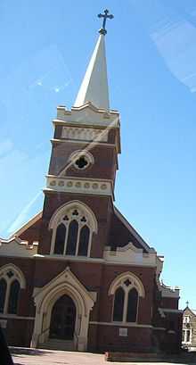
- St. George Greek Orthodox Church, Adelaide's largest Greek Orthodox church
- The Ice Arena, home of the Adelaide Adrenaline, who play in the Australian Ice Hockey League
- The Adelaide Gaol
References
- ↑ Premier Postal History. "Post Office List". Premier Postal Auctions. Retrieved 26 May 2011.
- Geoscience Australia
- South Australian State Gazetteer: Placenames Online
- The Manning Index of South Australian History
- Payne, P. (1996). Thebarton Old and New, Adelaide, SA: Thebarton City Council. ISBN 0-646-30157-8.
| |||||
Coordinates: 34°54′S 138°34′E / 34.900°S 138.567°E