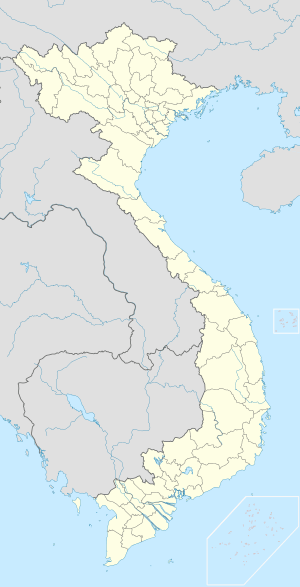
Thanh Hóa
| Thanh Hóa Provincial city | |
|---|---|
 | |
 Thanh Hóa | |
| Coordinates: 19°48′27″N 105°46′35″E / 19.80750°N 105.77639°E | |
| Country |
|
| Province | Thanh Hóa |
| Founded | 1994 |
| Government | |
| • Type | Municipality |
| • People's Committee Chairman: | Nguyễn Xuân Phi |
| • People's Council Chairman: | Hoàng Văn Hoằng |
| Area | |
| • Total | 22.3 sq mi (146 km2) |
| Population | |
| • Total | 400,000 |
| • Density | 18,000/sq mi (2,700/km2) |
| Area code(s) | +84 (37) |
| Website | http://thanhhoacity.gov.vn |
Thanh Hóa (![]() listen) is the capital city of Vietnam's Thanh Hóa Province.[1] The population is more than 400,000 inside an area of 146 square kilometers. The city is located south of the Sông Hồng (Red River) delta region, about 137 km south of Hanoi, on a small tributary of the Ma River (Sông Mã).
listen) is the capital city of Vietnam's Thanh Hóa Province.[1] The population is more than 400,000 inside an area of 146 square kilometers. The city is located south of the Sông Hồng (Red River) delta region, about 137 km south of Hanoi, on a small tributary of the Ma River (Sông Mã).
History
The Thanh Hóa (清化) town and region were an area of popular support for Lê Lợi and the Lê dynasty in the 1580s,[2] leading to the reestablishment of the southern court near the town following the withdrawal of Ming dynasty armies.[3] After 1945 the city was a stronghold of the Viet Cong. In January 1946 the Viet Cong transported all local cells of the VNQDD to the city.[4] During the Vietnam War, US strategic bombing destroyed much of the buildings and infrastructure, the whole city has been totally rebuilt since then.
Transport and industry
Thanh Hóa is linked with Hanoi by road and railway and considered to be a growing trade and industrial center. Agriculture, forestry and fishery are being developed here.
Buildings
Thanh Hóa has the Hoang Long Antique Museum, and the large Roman Catholic Cathedral of the Immaculate Conception with active services.
References
- ↑ Robert Trando Letters of a Vietnamese Émigre -2010 Page 144 "The name of its city is Thanh Hóa City."
- ↑ Keat Gin Ooi Southeast Asia: A Historical Encyclopedia, from Angkor Wat to East ... Volume 1 - Page 805 2004 "Mac efforts notwithstanding, many people went south to support the restoration of the Le dynasty in Thanh Hoa. Throughout the sixteenth century, Mac-Le animosity was played out on the battlefield."
- ↑ Vietnam Insight Guides 2002 - Page 20 "The southern court is founded near Thanh Hoa. 1592: The death of Mac dynasty's last king, Mac Mau Hop, ends the war."
- ↑ Van Dao Hoang Viet Nam Quoc Dan Dang: A Contemporary History of a National Struggle: 1927-1954 2008 Page 331 "Afterward, the VC transported all Party members and their weapons to Thanh Hóa city."
External links
![]() Media related to Thanh Hoa at Wikimedia Commons
Media related to Thanh Hoa at Wikimedia Commons
Coordinates: 19°48′27″N 105°46′35″E / 19.80750°N 105.77639°E
| |||||||||||||||||||||
| ||||||||||||||||||||||
