Tera, Paphos
From Wikipedia, the free encyclopedia
| Tera Τέρα | |
|---|---|
 Tera | |
| Coordinates: 34°57′58″N 32°25′27″E / 34.96611°N 32.42417°ECoordinates: 34°57′58″N 32°25′27″E / 34.96611°N 32.42417°E | |
| Country |
|
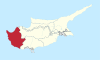
| District | Paphos District |
| Population (2001)[1] | |
| • Total | 19 |
| Time zone | EET (UTC+2) |
| • Summer (DST) | EEST (UTC+3) |
| Postal code | 6335 |
Tera (Greek: Τέρα) is a village in the Paphos District of Cyprus, located 1 km north of Kritou Tera. Prior to 1974, the village was inhabited by Turkish Cypriots.[2]
References
This article is issued from Wikipedia. The text is available under the Creative Commons Attribution/Share Alike; additional terms may apply for the media files.