Temurmalik District
From Wikipedia, the free encyclopedia

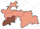
Location in Tajikistan
Temurmalik District or Nohiya-i Temurmalik (Tajik: Ноҳияи Темурмалик) is a district in Khatlon province of Tajikistan, located south of the Vakhsh Range along the middle course of Kyzylsu River.[1] Population 57,700 (2008 est.).[2] Before 1957 called Qizil-Mazor District (Tajik: Ноҳияи Қизил Мазор) or Kzyl-Mazar District (Russian: Кзыл-Мазарский район), then renamed Sovetskiy District (Russian: Советский район), and in 2004 given its present name Temurmalik District.[3][4] The new name honors a medieval military hero, Temurmalik (also Timur-Malik), who in 1220 led the people of Khujand in their struggle against the Mongol occupation.[5]
References
- ↑ Republic of Tajikistan, map showing administrative division as of January 1, 2004, "Tojikkoinot" Cartographic Press, Dushanbe
- ↑ Population of the Republic of Tajikistan as of 1 January 2008, State Statistical Committee, Dushanbe, 2008
- ↑ Qizil-Mazor (Kzyl-Mazar) district renamed Sovetskiy district, 1957 (Russian)
- ↑ Sovetskiy district renamed Temurmalik district, 2004 (Russian)
- ↑ B.A. Antonenko, History of Tajik SSR, Maorif Publ. House, Dushanbe (1983), p. 74; also see Temarmulik as a 13th century national hero (Russian)
| |||||||||||||
This article is issued from Wikipedia. The text is available under the Creative Commons Attribution/Share Alike; additional terms may apply for the media files.