Tehuacán
| Tehuacán | ||
|---|---|---|
| Town & Municipality | ||
| ||
 | ||
 | ||
|
Tehuacán | ||
| Coordinates: 18°28′N 97°24′W / 18.467°N 97.400°WCoordinates: 18°28′N 97°24′W / 18.467°N 97.400°W | ||
| Country |
| |
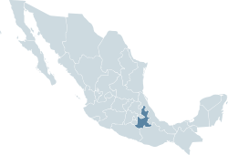
| State | Puebla | |
| Government | ||
| • Municipal President | Profr. Félix Alejo Domínguez | |
| Population (2010)Municipality | ||
| • Municipality | 274,906 hab. | |
| • Seat Density | 668/km2 (1,730/sq mi) | |
| Time zone | CST (UTC-6) | |
| Demonym | Tehuacanense or Tehuacanero | |
| Website | (Spanish) Municipal Official Site | |

Tehuacán is the second largest city in the Mexican state of Puebla, nestled in the Southeast Valley of Tehuacán, bordering the states of Oaxaca and Veracruz. The 2010 census reported a population of 248,716 in the city and 274,906 in its surrounding municipality of the same name, of which it serves as municipal seat. The municipality has an area of 390.36 km² (150.72 sq mi).[1]
Originally a Native American settlement, it became officially a city in the Viceroyalty of New Spain in 1660. According to the archaeologist Richard Stockton MacNeish, the Valley of Tehuacán is the first place maize was ever cultivated by humankind. He arrived at this conclusion when he found over 10,000 teoscintle cobs in what is now known as the Cave of Coxcatlan.
In the late nineteenth century, the city was well known for its mineral springs. In fact, Peñafiel (now owned by Cadbury Schweppes), a well known soft drinks manufacturer, extracts water from these wells for use in their products. Tehuacán also has an important cluster of poultry producers, making the city and its surroundings one of the most important egg producing regions in Mexico.[2]
After the NAFTA agreement had been signed, Tehuacán saw a flood of textile maquiladoras established in the city and surrounding areas. These textile factories principally put together blue jeans for export to companies such as The Gap, Guess, Old Navy, and JC Penney. At the height of the maquila (short for maquiladora) boom, there were an estimated number of more than 700 maquilas in town, including those that were operating from homes, often in secret. While this situation created a negative unemployment (zero unemployment) and the maquilas sought workers as far away as Orizaba and Córdoba in the neighboring state of Veracruz, it also created an urban and environmental nightmare. In one decade, Tehuacán went from being a town of 150,000 inhabitants to a city of 360,000. Although many maquilas have closed today, in 2007 there were still over 700 of them found in Tehuacán.[3] Due to the poverty of the families living in Tehuacán, child labour in the maquilas is common, and worker's rights are often exploited there. Additionally, chemicals such as caustic soda, chlorine, peroxide, oxalic acid, sodium bisulphate, potassium permanganate, and sodium hexametaphosphate are being discharged into the freshwater supplies by the jean laundries. Despite having new purifying technologies available at certain large facilities, they are still not being used the majority of the time. The water, which contains heavy metals such as mercury, lead, copper, zinc, chrome, cadmium and selenium is then used by the farmers to irrigate their land. The cost of environmental deterioration in 2002 was estimated to be $63 billion per year.[4]
Historically, the Valley of Tehuacán is important to the whole of Mexico, as the most ancient forms of cultivated maize known were found here by archeologists.
Geography
Tehuacán is located in the southeastern part of Mexico. Northern bordering cities are Tepanco de López, Santiago Miahuatlán, Vicente Guerrero y Nicolás Bravo; Eastern Vicente Guerrero, San Antonio Cañada y Ajalpan; Southern San Gabriel Chilac, Zapotitlán, San Antonio Texcala y Altepexi; and Western Zapotitlán, San Martín Atexcal, Juan N. Méndez y Tepanco de López.
Climate
| Climate data for Tehuacán (1951-2010) | |||||||||||||
|---|---|---|---|---|---|---|---|---|---|---|---|---|---|
| Month | Jan | Feb | Mar | Apr | May | Jun | Jul | Aug | Sep | Oct | Nov | Dec | Year |
| Record high °C (°F) | 31.0 (87.8) |
34.0 (93.2) |
36.0 (96.8) |
39.0 (102.2) |
39.0 (102.2) |
37.0 (98.6) |
34.0 (93.2) |
33.0 (91.4) |
34.0 (93.2) |
33.0 (91.4) |
36.0 (96.8) |
32.0 (89.6) |
39 (102.2) |
| Average high °C (°F) | 23.2 (73.8) |
25.2 (77.4) |
28.0 (82.4) |
29.8 (85.6) |
29.6 (85.3) |
27.3 (81.1) |
25.7 (78.3) |
26.2 (79.2) |
25.8 (78.4) |
24.8 (76.6) |
24.0 (75.2) |
23.2 (73.8) |
26.1 (79) |
| Daily mean °C (°F) | 14.4 (57.9) |
15.8 (60.4) |
18.4 (65.1) |
20.4 (68.7) |
21.0 (69.8) |
20.3 (68.5) |
19.0 (66.2) |
19.3 (66.7) |
19.2 (66.6) |
17.7 (63.9) |
16.0 (60.8) |
15.0 (59) |
18.0 (64.4) |
| Average low °C (°F) | 5.6 (42.1) |
6.6 (43.9) |
8.8 (47.8) |
11.0 (51.8) |
12.4 (54.3) |
13.4 (56.1) |
12.2 (54) |
12.3 (54.1) |
12.5 (54.5) |
10.7 (51.3) |
7.9 (46.2) |
6.7 (44.1) |
10.0 (50) |
| Record low °C (°F) | −5.0 (23) |
−5.0 (23) |
−4.0 (24.8) |
1.5 (34.7) |
3.0 (37.4) |
6.0 (42.8) |
6.0 (42.8) |
5.0 (41) |
5.0 (41) |
1.0 (33.8) |
−2.0 (28.4) |
−5.0 (23) |
−5 (23) |
| Precipitation mm (inches) | 5.4 (0.213) |
5.5 (0.217) |
7.1 (0.28) |
21.5 (0.846) |
61.0 (2.402) |
99.2 (3.906) |
67.3 (2.65) |
65.7 (2.587) |
83.3 (3.28) |
29.5 (1.161) |
7.8 (0.307) |
2.6 (0.102) |
455.9 (17.949) |
| Avg. precipitation days (≥ 0.1 mm) | 1.2 | 1.2 | 1.7 | 4.0 | 8.0 | 10.6 | 9.4 | 9.2 | 11.2 | 5.1 | 2.0 | 1.1 | 64.7 |
| Source: Servicio Meteorologico Nacional[5] | |||||||||||||
See also
- Tehuacán Valley matorral — Deserts and xeric shrublands ecoregion in the Valley.
Notes
- ↑ Population data from Census of 2005. INEGI: Instituto National du Estadistica y Geographia (2011). INEGI - México en cifras.
- ↑ Instituto para el Federalismo y el Desarrollo Municipal (2010). Puebla Enciclopedia de los Municipios de México.
- ↑ Jo Tuckman (August 17, 2007). "Distressed denim trend costs Mexican farmers the earth". Retrieved January 23, 2011.
- ↑ Maquila Solidarity Network (February 2003). Tehuacan: Blue Jeans, Blue Waters, and Worker Rights.
- ↑ NORMALES CLIMATOLÓGICAS 1951-2010 (in Spanish). National Meteorological Service of Mexico. Retrieved August 30, 2012.
External links
| Wikimedia Commons has media related to Tehuacán, Puebla. |
- Diving Destiny Circle of Blue tells the story of one Tehuacán Valley community's response to Mexico's worst water crisis in decades.
- Tehuacán municipal government Official website (Spanish)
- Tehuacán, Puebla Information Tehuacán, Puebla Information (Spanish)
- tehuacan.com.mx, El Portal de la Ciudad tehuacan.com.mx, El Portal de la Ciudad. Directorio Empresarial en Línea
- Tehuacan News Noticias al dia de Tehuacán