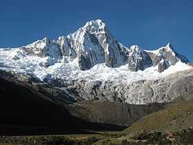
Tawllirahu
| Tawllirahu | |
|---|---|
 | |
| Elevation | 5,830 m (19,127 ft)[1] |
| Location | |
 Tawllirahu | |
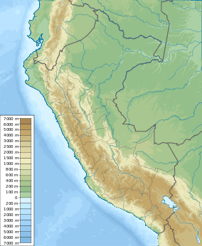
| Location | Peru, Ancash Region |
| Range | Andes, Cordillera Blanca |
| Coordinates | 8°53′33″S 77°34′45″W / 8.89250°S 77.57917°WCoordinates: 8°53′33″S 77°34′45″W / 8.89250°S 77.57917°W |
Tawllirahu (Quechua tawlli a kind of legume,[2] rahu snow, ice, mountain with snow,[3] hispanicized spelling Taulliraju) is a mountain in the Cordillera Blanca in the Andes of Peru, about 5,830 metres (19,127 ft) high.[4] It is situated in the Ancash Region, Huaylas Province, Santa Cruz District as well as in the Pomabamba Province, Pomabamba District. Tawllirahu lies in the Huascarán National Park, south east of the Pukahirka and east of the Rinrihirka.
Climbing
There are plenty routes, but no easy to climb this spectacular mountain. The easier two are perhaps the south-southeast ridge or the north face, all other routes are more difficult. The south-southeast ridge and the north face are rated TD-, the south buttress is TD, the southwest face is ED1 and the east buttress is ED1/ED2.
The east buttress, known also as Fowler-Watts route was climbed on the 26 May 1982 and since has defeated many competent parties. It is a serious undertaking on mixed ground, steep section of rock (difficulty UIAA V+) and vertical rotten ice.
See also
References
- ↑ allthemountains.com Map of a part of the Cordillera Blanca
- ↑ Ana Arias Torre, Toponimia de Ticabamba, in LETRAS, Órgano de la Facultad de Letras y Ciencias Humanas , Universidad Nacional Mayor de San Marcos, Lima 2002: tawlli - Tipo de legumbre, muy parecido al chocho
- ↑ babylon.com
- ↑ www.andix.com Map of a part of the Cordillera Blanca
External links
| Wikimedia Commons has media related to Tawllirahu. |