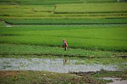
Ta Kaeo (Khmer: ខេត្តតាកែវ, IPA: [taː kaeːw] literally "crystal grandfather") is a province (khaet) of Cambodia. Located in the southwest of Cambodia, Takeo borders the provinces of Kampot to the west, Kampong Speu to the northwest and Kandal to the north and east. Its southern boundary is the international border with Vietnam. The provincial capital, also named Takéo, is a small city with a population of 39,186.
Takéo is often referred to as the "cradle of Khmer civilization" due to the former kingdom of Funan its successor, Water Chenla, being centered in the region.
People
Administration
The province is subdivided into 10 districts, 100 communes and 1117 villages.[2][3]
| district code | Name of District | In Khmer |
| 2101 | Angkor Borei | អង្គរបុរី |
| 2102 | Bathi | បាទី |
| 2103 | Borey Cholsar | បុរីជលសារ |
| 2104 | Kirivong | គីរីវង្ស |
| 2105 | Koh Andaet | កោះអណ្តែត |
| 2106 | Prey Kabbas | ព្រៃកប្បាស |
| 2107 | Samraong | សំរោង |
| 2108 | Daun Kaev | ដូនកែវ |
| 2109 | Tram Kak | ត្រាំកក់ |
| 2110 | Treang | ទ្រាំង |
|
See also
References


