Swiss Prealps
From Wikipedia, the free encyclopedia
| Swiss Prealps | |
|---|---|
| French: Préalpes Suisses | |
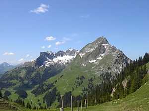
 The top of the Schilthorn | |
| Highest point | |
| Peak | Schilthorn |
| Elevation | 2,970 m (9,740 ft) |
| Coordinates | 46°33′26″N 7°50′07″E / 46.55722°N 7.83528°ECoordinates: 46°33′26″N 7°50′07″E / 46.55722°N 7.83528°E |
| Geography | |
| Country |
|
| Borders on | Savoy Prealps, Bernese Alps, Glarus Alps and Western Rhaetian Alps |
| Geology | |
| Orogeny | Alpine orogeny |
The Swiss Prealps (Préalpes Suisses in French, Schweizerische Voralpen in German) are a mountain range in the north-western part of the Alps. Swiss Prealps are the northernmost section the Western Alps.
Geography
The Swiss Prealps concern several cantons; from south-west to north-east they are:
- Vaud,
- Fribourg,
- Bern,
- Lucerne,
- Obwalden,
- Nidwalden,
- Uri,
- Schwyz,
- Zug,
- Glarus
- Zurich (marginally on the north of the range),
- Canton of Graubünden (marginally on the south of the range),
- Canton of St. Gallen,
- Canton of Appenzell Innerrhoden,
- Canton of Appenzell Ausserrhoden.
Their southwestern part belongs to the Rhone drainage basin while the northeastern one is drained by the Rhine.
Notable summits

The Dent de Brenleire, in the SW part of the range
Some notable summits of the range are:
| Name | metres | feet |
|---|---|---|
| Schilthorn | 2,970 | 9,744 |
| Albristhorn | 2,762 | 9,062 |
| Dent de Brenleire | 2,353 | 7,720 |
| Le Tarent | 2,548 | 8,360 |
| Vanil Noir | 2,389 | 7,838 |
| Säntis | 2,502 | 8,209 |
| Rigi | 1,797 | 5,896 |
| Ruchstock | 2,814 | 9,232 |
Notable passes

Kleine Scheidegg mountain pass
Some notable passes of the range are:
| Name | metres | feet |
|---|---|---|
| Kleine Scheidegg | 2,061 | 6,792 |
| Grosse Scheidegg | 1,961 | 6,434 |
| Col de la Croix | 1,778 | 5,833 |
| Pragel Pass | 1,548 | 5,079 |
| Col du Pillon | 1,546 | 5,072 |
| Jaunpass | 1,509 | 4,951 |
| Saanenmöser Pass | 1,279 | 4,196 |
| Col des Mosses | 1,916 | 6,286 |
| Schwägalp Pass | 1,278 | 4,193 |
| Wildhaus Pass | 1,090 | 3,576 |
| Brünig Pass | 1,008 | 3,037 |
References
Maps
- Swiss official cartography (Swiss Federal Office of Topography - Swisstopo); on-line version: map.geo.admin.ch
This article is issued from Wikipedia. The text is available under the Creative Commons Attribution/Share Alike; additional terms may apply for the media files.