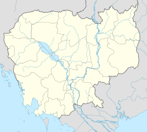
Svay Chek District
| Svay Chek ស្រុកស្វាយចេក | |
|---|---|
| District (srok) | |
 | |
 Svay Chek | |
| Coordinates: 13°40′N 103°0′E / 13.667°N 103.000°ECoordinates: 13°40′N 103°0′E / 13.667°N 103.000°E | |
| Country |
|
| Province | Banteay Meanchey |
| Communes | 8 |
| Villages | 63 |
| Population (1998)[1] | |
| • Total | 47,960 |
| Time zone | +7 |
| Geocode | 0108 |
Svay Chek (Khmer: ស្រុកស្វាយចេក, "Mangoes Bananas") is a district (srok) in the north of Banteay Meanchey Province, in north-western Cambodia. The district capital is Svay Chek town located around 22 kilometres north of the provincial capital of Sisophon by road. The district shares a border with Thailand to the west. No national highway runs through the district but national road 56 from Sisophon to Samraong in Oddar Meanchey province crosses the district from north to south.[2]
The district is easily accessed by road from Sisophon (22 km) Battambang (city) (90 km) and Siem Reap (city) (124 km). Svay Chek District is one of the smaller districts in Banteay Meanchey province and also has the smallest population after Malai and Phnom Srok. The western half of the district towards Thailand is largely unpopulated. There are no official border crossings in the district but one provincial road begins near Phnom Srok and crosses the district to end at the Thai border. Numerous smaller roads also run to the Thai border in the western half of the district.[3]
The K5 Plan
The western part of Svay Chek district is part of the heavily mined K5 belt which lies just inside the Cambodian border with Thailand.[4] The K5 minefield is 700 kilometres long and 400– 500 metres wide. It runs along the Thai Cambodian border.[5]
Location
Svay Chek district lies in the north of the province and shares a border with Sa Kaeo Province of Thailand. Reading from the north clockwise, Svay Chek borders with Thma Pouk district to the north. The eastern border of the district is shared with Phnom Srok district in the north east and Preah Netr Preah in the south east. To the south the district shares a border with Serei Saophoan and Ou Chrov districts. The western border of the district joins with Khok Sung District of Sa Kaeo province in Thailand.[6]
Administration
The Svay Chek district governor reports to His Excellency Oung Ouen, the Governor of Banteay Meanchey. The following table shows the villages of Svay Chek district by commune.
| Khum (Commune) | Phum (Villages) |
|---|---|
| Phkoam | Phkoam, Yeang Vien, Yeang, Ampil, Ou, Prasat Vien, Ta Duol, Svay Sa, Mau, Thma Koul, Ta Kul |
| Roluos | Baek Chan Thmei, Khvav Kaeut, Stueng, Ta Ong Kaeut, Slaeng, Roluos, Ta Sman |
| Sarongk | Pheas Tboung, Pheas Cheung, Chrung, Phlas Kang, Kouk Phlu, Kantrong |
| Sla Kram | Sla Kram, Kakaoh, Kamnab, Toap Siem, Khlaeng Poar Akphivoat, Prasat, Kouk Ampil, khlaeng Poar |
| Svay Chek | Kouk Khvav, Ponsay Cheung, Kloeng, Baek Chan Chas, Ponsay Tboung, Roka Thmei, Ta Ong Lech, Slaeng, Thmei, Khvav Lech, Samraong, Chamkar Kor, Damnak Kokos, Lboek Svay |
| Ta Baen | Kouk Ta Aek, Ou Veaeng, Ta Baen, Kouk Roka, Ou Veaeng Tboung |
| Ta Phou | Ta Phou, Pongro, Ta Srei, Prech Kei, Kouk Kei, Khmoas, Thmei, Baray, Phchoek, Prech Tboung, Bantoat Baoh |
| Treas | Thmei, Chaeng, Doun Nouy, Prei, Ponley Chas, Treas, Ampil Prong, Ou Kakaoh, Ta Voek |
Demographics
The district is subdivided into 8 communes (khum) and 63 villages (phum).[7] According to the 1998 Census, the population of the district was 47,960 persons in 10,079 households in 1998. This population consisted of 23,491 males (49.0%) and 24,469 females (51.0%). With a population of under 50,000 people, Svay Chek has one of the smallest district populations in Banteay Meanchey province. Only Malai and Phnom Srok districts are smaller. The average household size in Svay Chek is 4.8 persons per household, which is slightly smaller than the rural average for Cambodia (5.2 persons). The sex ratio in the district is 96.0%, with slightly more females than males.[8]
References
- ↑ General Population Census of Cambodia, 1998: Village Gazetteer. National Institute of Statistics. February 2000. pp. 13–14.
- ↑ Total Road Atlas of Cambodia 2006 (3rd edition ed.). Total Cambodge. 2006. p. 32.
- ↑ Cambodia Road Network (Version 03-00 ed.). Ministry of Public Works and Transport. 2001.
- ↑ "International Programs: Cambodia". Austcare. January 2009. p. 2. Retrieved 2009-03-27.
- ↑ Thomas, Kate (27 June 2006). "Former child soldier digs up mines he helped lay". The Independent. Retrieved 2009-03-27.
- ↑ "Banteay Meanchey Provincial Resources". Ministry of Commerce. Retrieved 2009-02-15.
- ↑ "Banteay Meanchey Administration". Royal Government of Cambodia. Retrieved 2009-01-22.
- ↑ General Population Census of Cambodia, 1998: Village Gazetteer. National Institute of Statistics. February 2000. pp. 1–15.
External links
- Banteay Meanchey at Royal Government of Cambodia website
- Banteay Meanchey at the Ministry of Commerce website
| ||||||||||||||||||||||||||||||||
| ||||||||||
