Surathkal
| Surathkal | |
|---|---|
| Neighbourhood | |
 | |
 Surathkal | |
| Coordinates: 12°59′00″N 74°47′00″E / 12.9833°N 74.7833°ECoordinates: 12°59′00″N 74°47′00″E / 12.9833°N 74.7833°E | |
| Country |
|
| State | Karnataka |
| District | Dakshina Kannada |
| Elevation | 24 m (79 ft) |
| Languages | |
| Time zone | IST (UTC+5:30) |
| PIN | 575014 |
| Telephone code | 0824 |
| Vehicle registration | KA-19 |
Surathkal is a suburb of Mangalore city located on National highway 17 (now renumbered as NH-66) in the Dakshina Kannada district, Karnataka state, India. It is a municipality merged with Mangalore City Corporation.
Etymology
According to legend, the name Surathkal is derived from "shiratakal" meaning "headstone" in Tulu. The famous Sadashiva temple is said to be built around the linga that a Rakshasa by name Kharasura carried on his head.
Administration
Surathkal was once a Grama panchayat, then town panchayat, municipality now merged with Mangalore City Corporation.
Education
Surathkal is home to one of India's premier technical institutes - The National Institute of Technology Karnataka (NITK), formerly known as Karnataka Regional Engineering College (KREC). Surathkal also houses Vidyadayanee High School and Govindadasa College run by Hindu Vidyadayanee Sangha, Surathkal. Other notable Educational institutes include Sri Mahalingeshwara English medium school and Holy Family School.
Travel
Surathkal town can be easily accessed by various bus services from Mangalore City by both city buses and the Mangalore-Udupi Express buses.The nearest airport is Mangalore (Bajpe), 15 kilometres from Surathkal.The New Mangalore sea port is 6 km away. The railway station at Surathkal lies between Mangalore and Udupi on Konkan railway route.
Places Of Interest
National Institute of Technology Karnataka.

NITK Beach.
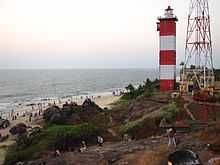
Lighthouse.

Shri Sadashiva Mahaganapati Temple.
Iddya Shri Mahalingeshwara Temple.
Srinivas institute of medical science & research centre
Geography

Surathkal is located at 12°58'60 N 74° 46' 60E.[3] The maximum and minimum temperature in a year varies between 37 °C and 21 °C.
Industry
Some of the major industries in and around Surathkal are MRPL, BASF and MCF.The Baikampady Industrial Estate is located at around 6 kilometres from Surathkal and houses many small and medium sized industries. The raw materials to these industries are imported through the Mangalore port and goods produced here are exported to several places in India and abroad through this port.
See also
- Mangalorean regionalism
External links
| Wikimedia Commons has media related to Surathkal. |
References
- ↑ "Surathkal Beach". http://www.mapsofindia.com. Retrieved 2011-09-11.
- ↑ "Surathkal Beach – Stretch Your Legs in Surathkal!". http://www.karnataka.com. Retrieved 2012-08-03.
- ↑ Falling Rain Genomics, Inc - Surathkal