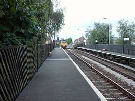
Streethouse railway station
From Wikipedia, the free encyclopedia
| Streethouse | |
|---|---|
 | |
| Platform 1 | |
| Location | |
| Place | Streethouse |
| Local authority | City of Wakefield |
| Coordinates | 53°40′34″N 1°24′00″W / 53.6762°N 1.4000°WCoordinates: 53°40′34″N 1°24′00″W / 53.6762°N 1.4000°W |
| Grid reference | SE397201 |
| Operations | |
| Station code | SHC |
| Managed by | Northern Rail |
| Number of platforms | 2 |
|
Live arrivals/departures and station information from National Rail Enquiries | |
| Annual rail passenger usage* | |
| 2004/05 | 23,492 |
| 2005/06 |
|
| 2006/07 |
|
| 2007/08 |
|
| 2008/09 |
|
| 2009/10 |
|
| 2010/11 |
|
| Passenger Transport Executive | |
| PTE | West Yorkshire (Metro) |
| Zone | 3 |
| History | |
| Opened 1992 | |
| National Rail – UK railway stations | |
| A B C D E F G H I J K L M N O P Q R S T U V W X Y Z | |
| * Annual estimated passenger usage based on sales of tickets in stated financial year(s) which end or originate at Streethouse from Office of Rail Regulation statistics. Methodology may vary year on year. | |
|
| |
Streethouse railway station serves the village of Streethouse in West Yorkshire, England. It lies on the Pontefract Line, operated by Northern Rail and is 4 miles (6 km) east of Wakefield Kirkgate railway station.
The station was opened by Metro (West Yorkshire Passenger Transport Executive) on 12 May 1992 when the line between Wakefield and Pontefract was re-opened.
Service
On Monday to Saturday, there is an hourly service to Wakefield Kirkgate and Knottingley. There are no trains on Sundays.
External links
- Train times and station information for Streethouse railway station from National Rail
| Preceding station | Following station | |||
|---|---|---|---|---|
| Northern Rail Mondays-Saturdays only |
| |||||||||||||||||||||||
This article is issued from Wikipedia. The text is available under the Creative Commons Attribution/Share Alike; additional terms may apply for the media files.