Stiwoll
From Wikipedia, the free encyclopedia
| Stiwoll | ||
|---|---|---|
| ||
 Stiwoll | ||
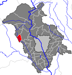
Location within Graz-Umgebung district
| ||
| Coordinates: 47°06′08″N 15°13′09″E / 47.10222°N 15.21917°ECoordinates: 47°06′08″N 15°13′09″E / 47.10222°N 15.21917°E | ||
| Country | Austria | |
| State | Styria | |
| District | Graz-Umgebung | |
| Government | ||
| • Mayor | Willi Zenz (ÖVP) | |
| Area | ||
| • Total | 12.96 km2 (5.00 sq mi) | |
| Elevation | 495 m (1,624 ft) | |
| Population (1 January 2013)[1] | ||
| • Total | 707 | |
| • Density | 55/km2 (140/sq mi) | |
| Time zone | CET (UTC+1) | |
| • Summer (DST) | CEST (UTC+2) | |
| Postal code | 8113 | |
| Area code | 03142 | |
| Vehicle registration | GU | |
| Website | www.stiwoll.steiermark.at | |

Stiwoll is a municipality in the district of Graz-Umgebung in the Austrian state of Styria.
Population
| Historical population | ||
|---|---|---|
| Year | Pop. | ±% |
| 1869 | 720 | — |
| 1880 | 792 | +10.0% |
| 1890 | 782 | −1.3% |
| 1900 | 748 | −4.3% |
| 1910 | 733 | −2.0% |
| 1923 | 735 | +0.3% |
| 1934 | 781 | +6.3% |
| 1939 | 741 | −5.1% |
| 1951 | 759 | +2.4% |
| 1961 | 683 | −10.0% |
| 1971 | 725 | +6.1% |
| 1981 | 716 | −1.2% |
| 1991 | 699 | −2.4% |
| 2001 | 701 | +0.3% |
References
This article is issued from Wikipedia. The text is available under the Creative Commons Attribution/Share Alike; additional terms may apply for the media files.