Starrucca, Pennsylvania
| Borough of Starrucca | |
| Borough | |
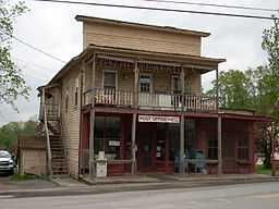 The Starrucca post office | |
| Country | United States |
|---|---|
| State | Pennsylvania |
| County | Wayne |
| Elevation | 1,378 ft (420 m) |
| Coordinates | 41°53′58″N 75°27′40″W / 41.89944°N 75.46111°W |
| Area | 8.8 sq mi (22.8 km2) |
| - land | 8.7 sq mi (23 km2) |
| - water | 0.04 sq mi (0 km2), 0.45% |
| Population | 173 (2010) |
| Density | 19.9 / sq mi (7.7 / km2) |
| Timezone | EST (UTC-5) |
| - summer (DST) | EDT (UTC-4) |
| ZIP code | 18462 |
| Area code | 570 Exchange: 727 |
 Location of Starrucca in Pennsylvania
| |
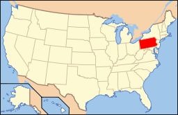 Location of Pennsylvania in the United States
| |
Starrucca is a borough in Wayne County, Pennsylvania, United States. The population was 173 at the 2010 census.
History
The former Stone Arch Bridge was listed on the National Register of Historic Places from 1979 to 1986.[1]
Geography
Starrucca is located at 41°53′58″N 75°27′40″W / 41.89944°N 75.46111°W (41.899334, -75.461135)[2].
According to the United States Census Bureau, the borough has a total area of 8.8 square miles (23 km2), of which, 8.7 square miles (23 km2) of it is land and 0.04 square miles (0.10 km2) of it (0.23%) is water.
Demographics
| Historical population | |||
|---|---|---|---|
| Census | Pop. | %± | |
| 1860 | 400 | ||
| 1870 | 476 | 19.0% | |
| 1880 | 535 | 12.4% | |
| 1890 | 431 | −19.4% | |
| 1900 | 404 | −6.3% | |
| 1910 | 381 | −5.7% | |
| 1920 | 397 | 4.2% | |
| 1930 | 351 | −11.6% | |
| 1940 | 340 | −3.1% | |
| 1950 | 326 | −4.1% | |
| 1960 | 330 | 1.2% | |
| 1970 | 292 | −11.5% | |
| 1980 | 216 | −26.0% | |
| 1990 | 199 | −7.9% | |
| 2000 | 216 | 8.5% | |
| 2010 | 173 | −19.9% | |
| Est. 2012 | 169 | −2.3% | |
| Sources:[3][4][5] | |||
As of the census[6] of 2010, there were 173 people, 75 households, and 52 families residing in the borough. The population density was 19.9 people per square mile (7.7/km²). There were 127 housing units at an average density of 14.6 per square mile. The racial makeup of the borough was 96% White, 1.7% African American, 0.6% Asian, 0.6% from other races, and 1.2% from two or more races. Hispanic or Latino of any race were 4% of the population.
There were 75 households out of which 20% had children under the age of 18 living with them, 56% were married couples living together, 6.7% had a female householder with no husband present, and 30.7% were non-families. 28% of all households were made up of individuals and 12% had someone living alone who was 65 years of age or older. The average household size was 2.31 and the average family size was 2.69.
In the borough the population was spread out with 16.8% under the age of 18, 64.7% from 18 to 64, and 18.5% who were 65 years of age or older. The median age was 49.3 years.
The median income for a household in the borough was $34,500, and the median income for a family was $37,750. Males had a median income of $33,333 versus $20,000 for females. The per capita income for the borough was $23,071. About 12.0% of families and 18.4% of the population were below the poverty line, including 36.1% of those under the age of eighteen and 21.2% of those sixty five or over.
References
- ↑ "National Register Information System". National Register of Historic Places. National Park Service. 2010-07-09.
- ↑ "US Gazetteer files: 2010, 2000, and 1990". United States Census Bureau. 2011-02-12. Retrieved 2011-04-23.
- ↑ "Census of Population and Housing". U.S. Census Bureau. Retrieved 11 December 2013.
- ↑ "American FactFinder". United States Census Bureau. Retrieved 2008-01-31.
- ↑ "Incorporated Places and Minor Civil Divisions Datasets: Subcounty Resident Population Estimates: April 1, 2010 to July 1, 2012". Population Estimates. U.S. Census Bureau. Retrieved 11 December 2013.
- ↑ "American FactFinder". United States Census Bureau. Retrieved 2011-05-14.
| ||||||||||||||||||||
