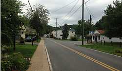
Sperryville, Virginia
| Sperryville | |
|---|---|
| Unincorporated community | |
 | |
 Sperryville | |
| Coordinates: 38°39′25″N 78°13′34″W / 38.65694°N 78.22611°WCoordinates: 38°39′25″N 78°13′34″W / 38.65694°N 78.22611°W | |
| Country | United States |
| State | Virginia |
| County | Rappahannock |
| Elevation | 700 ft (200 m) |
| Population (2010) | |
| • Total | 342 |
| Time zone | Eastern (EST) (UTC-5) |
| • Summer (DST) | EDT (UTC-4) |
| ZIP codes | 22740 |
| Area code(s) | 540 |
Sperryville is a census-designated place (CDP) in Rappahannock County, Virginia, USA. The population as of the 2010 Census was 342.[1]
History
Located in the southeast section of Rappahannock County, Virginia, along the Thornton River,[2] Sperryville was laid out by Francis Thornton, Jr. in 1817. For most of the early 19th century Conestoga wagons were built by John Kiger.[3] By the 1850, Sperryville boasted two turnpikes: Thornton's Gap and Sperryville & Rappahannock. In the 1860s the Smoot family of Alexandria build a tannery on the Thornton River[4] that closed by 1911. By that time Sperryville had grown to 350 residents with four churches, five general stores, one hotel, six mills, shops, and a masonic hall. The Sperryville Historic District is listed on the Virginia Landmarks Registry and the National Register of Historic Places.[5]

Attractions
Sperryville is close to many outdoor activities. The town is at the foothills of the Blue Ridge Mountains and provides access to the panorama entrance[6] of Shenandoah National Park that provides access to Skyline Drive,[7] which is a continuation of the Blue Ridge Parkway of the Great Smokey Mountains. Hiking spots include the popular Old Rag Mountain,[8] White Oak Canyon,[9] and Thornton River Trail,[10] which are all located within the Shenandoah National Park.
The Copper Fox Distillery, a distiller of American whiskey, is based in Sperryville.
In popular culture
Sperryville is the setting for parts of the 8th Jack Reacher novel, The Enemy, by Lee Child.
References
- ↑ Virginia Trend Report 2: State and Complete Places (Sub-state 2010 Census Data). Missouri Census Data Center. Accessed 2011-06-08.
- ↑ "Get to Know Rappahannock". County of Rappahannock. Retrieved April 5, 2011.
- ↑ Arnold, Scott (2007). A Guidebook to Virginia's Historical Markers. Charlottesville: University of Virginia Press. p. 73.
- ↑ Hite, Mary (1950). My Rappahannock (Virginia) Story Book. Richmond, Virginia: The Dietz Press Incorpotated. pp. 143–145.
- ↑ Lynch, Kathryn (2007). Images of America: Rappahannock County. Charleston, SC: Arcadia Publishing. pp. 45–70.
- ↑ "Welcome to Sperryville, VA". ShenValley Web Hosting. Retrieved April 6, 2011.
- ↑ Silas House (2006). Encyclopedia of Appalachia.
- ↑ Virginia Economic Development Partnership. "Sperryville, VA". Virginia is for Lovers. Retrieved April 6, 2011.
- ↑ National Park Service. "White Oak Canyon Trail and Route Map". Department of the Interior. Retrieved April 12, 2010.
- ↑ "Thornton River Trail". Trails.com, Inc. Retrieved April 12, 2011.
Further reading
- Hanson, Raus (1969). From Virginia Place Names. Verona, Virginia: McClure Press. ISBN
- Arnold, Scott (2007). A Guidebook to Virginia's Historical Markers. Charlottesville: University of Virginia Press. ISBN 978-0-8139-2572-1.
- Hite, Mary (1950). My Rappahannock (Virginia) Story Book. Richmond, Virginia: The Dietz Press Incorpotated. ISBN
- Lynch, Kathryn (2007). Images of America: Rappahannock County. Charleston, SC: Arcadia Publishing. ISBN 0-7385-4384-5.
- McCarthy, Eugene (1984). The View from Rappahannock. McLean, Virginia: EPM Publications, Inc.. ISBN 0-914440-79-9.
External links
| ||||||||||||||||||||
