Society Hill, Philadelphia
|
Society Hill Historic District | |
 | |
|
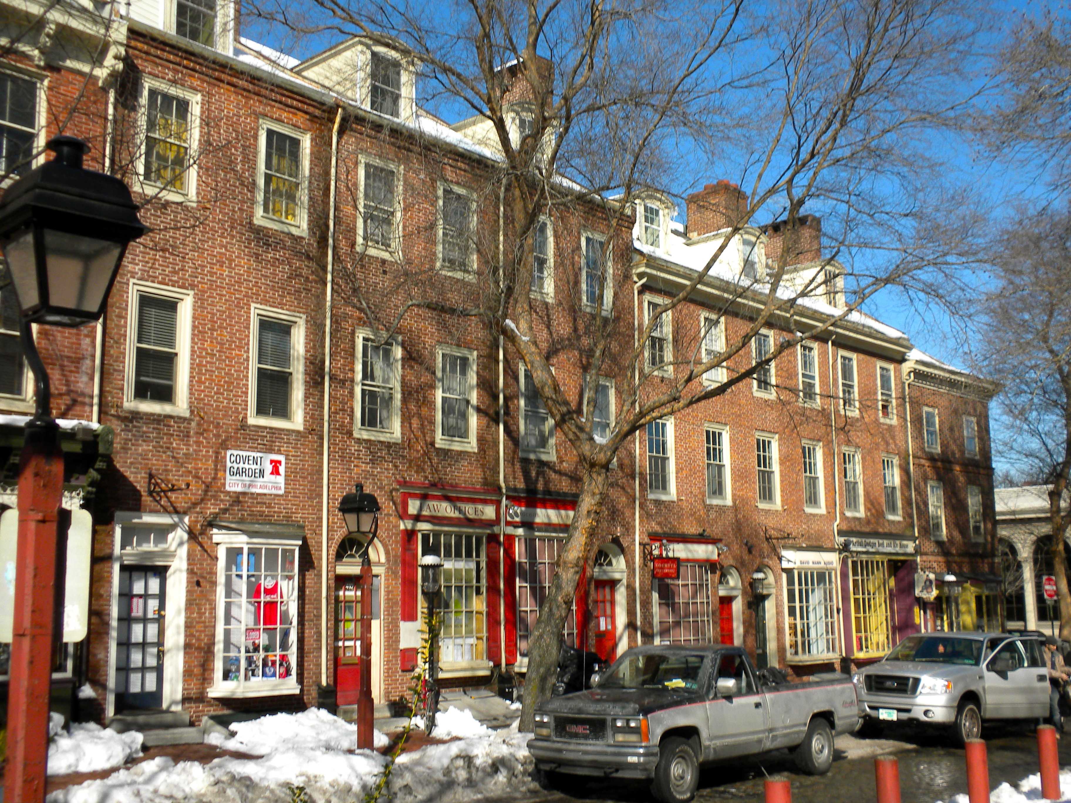
Head House Square on the 400 block of S. 2nd Street | |
 | |
| Location | Bounded on the N by Walnut St., on the S by Lombard St., on the E by pier line of Delaware River, and on the W by 8th, Philadelphia, Pennsylvania |
|---|---|
| Coordinates: 39°56′42″N 75°8′58″W / 39.94500°N 75.14944°W | |
| Area | 135 acres (55 ha) |
| Architect | multiple |
| Architectural style | Georgian, Federal, other |
| Governing body | National Park Service |
| NRHP Reference # | 71000065[1] |
| Significant dates | |
| Added to NRHP | June 23, 1971 |
| Designated PRHP | March 10, 1999[2] |
Society Hill is a neighborhood in the Center City section of Philadelphia, Pennsylvania. The neighborhood, loosely defined as bounded by Walnut, Lombard, Front and 8th Streets, contains the largest concentration of original 18th- and early 19th-century residential architecture of any place in the United States.[citation needed] Society Hill is noted as a charming district with cobblestone streets bordered by brick rowhouses in Federal and Georgian style.
History
The district is named after the 18th century Free Society of Traders, which had its offices at Front Street on the hill above Dock Creek. Located close to both the Delaware River and Philadelphia's civic buildings, including the Independence Hall, the neighborhood soon became one of the city's most populous areas.
Several market halls, taverns and churches were built alongside brick houses of Philadelphia's affluent citizens.
In the 19th century, the city expanded westward and the area lost its appeal. Houses deteriorated, and by the 1940s, Society Hill had become a slum neighborhood, one of the worst in the city.[3] In the 1950s, the city, state and federal governments began one of the first urban renewal programs aimed at the preservation of historic buildings. While most commercial 19th-century buildings were demolished, historically-significant houses were restored by occupants or taken over by the Philadelphia Redevelopment Authority and sold to individuals who agreed to restore the exteriors. Replicas of 18th-century street lights and brick sidewalks were added to enhance the colonial atmosphere. Empty lots and demolished buildings were replaced with parks, walkways, and modern townhouses.
From 1957-1959, the Greater Philadelphia Movement, the Redevelopment Authority and the Old Philadelphia Development Corporation bought 31 acres (130,000 m2) around Dock Street. They demolished and relocated the Dock Street market, setting aside 5 acres (20,000 m2) of land that would become the Society Hill Towers.[4]
In 1957, Edmund Bacon, the executive director of the Philadelphia City Planning Commission, awarded developer-architect firm Webb and Knapp the competition for the redevelopment of Society Hill. Architect I. M. Pei and his team designed a plan for three 31-story Society Hill Towers and low-rise buildings.[5] The Towers and townhouses project was completed in 1964, while the entire plan was completed in 1977.[6] Architect Louis Sauer designed dozens of rowhouse projects for the area around Society Hill, including Waverly Court and Penn's Landing Square.
Historic buildings in Society Hill include the Society Hill Synagogue, built in 1829 as a Baptist church by Philadelphia architect Thomas U. Walter, one of the architects of the United States Capitol in Washington, DC. The synagogue was entered into the National Register of Historic Places in 1971. Another notable building is St. Peter's Church, constructed between 1758 and 1761 by Robert Smith.
The Society Hill Historic District was listed on the National Register of Historic Places in 1971. In 1999, it was listed on the Philadelphia Register of Historic Places.[2]
Education
Society Hill residents are assigned to schools in the School District of Philadelphia. Residents are zoned to the General George A. McCall School, located in Society Hill,[7] for grades Kindergarten through 8[8][9] and Furness High School for high school.[10]
Public library
The Free Library of Philadelphia operates the Independence Branch at 18 South 7th Street.[11]
Gallery
-

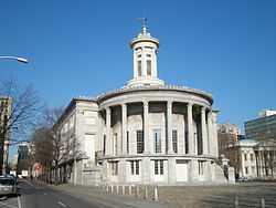
Merchants' Exchange Building, National Historic Landmark
-
Drinker House at 241 Pine Street
-

Independence Branch Library
See also
- Independence National Historical Park
- The Cassey House
- National Register of Historic Places listings in Center City, Philadelphia
References
Notes
- ↑ "National Register Information System". National Register of Historic Places. National Park Service. 2009-03-13.
- ↑ 2.0 2.1 "PRHP: List of historic districts". Philadelphia Historical Commission. Retrieved 03-12-2013.
- ↑ Gallery, John Andrew (ed.) (2004). Philadelphia Architecture: A Guide to the City (2nd ed.). Philadelphia: Foundation for Architecture. ISBN 0962290815., p.119
- ↑ Le Faivre-Rochester, Carole. "Society Hill Towers: A Bold and Graceful Venture." I.M. Pei and Society Hill: A 40th Anniversary Celebration. Ed. Herman Baron. Philadelphia: DIANE Publishing Co., 2003: 35. Google Books. .
- ↑ Perkins, Dorothy. "Biography of I.M. Pei." I.M. Pei and Society Hill: A 40th Anniversary Celebration. Ed. Herman Baron. Philadelphia: DIANE Publishing Co., 2003: 8. Google Books. .
- ↑ Le Faivre-Rochester, p. 36.
- ↑ Jackson, Leigh. "SCHOOL BOARD TACK: SLASH, UNSLASH." Philadelphia Daily News. May 28, 1994. 06 Local. Retrieved on November 8, 2011.
- ↑ K-8 Public Schools Boundary Map." Center City Schools. Retrieved on November 7, 2008.
- ↑ "Map - McCall." Center City District. Retrieved on November 7, 2008.
- ↑ "Where the Graduates Go." George A. McCall School. Retrieved on November 7, 2008.
- ↑ "Independence Branch." Free Library of Philadelphia. Retrieved on January 20, 2009.
External links
| Wikimedia Commons has media related to Society Hill, Philadelphia. |
- Society Hill Civic Association
- Society Hill Playhouse
- Historic Photographs of Society Hill, PhillyHistory.org
- Society Hill Magazine, a Guide to Society Hill and Historic Philadelphia
| ||||||||||||||||||||


