Snake Range
| Snake Range | |
|---|---|
 Wheeler Peak, highest mountain in the Snake Range | |
| Highest point | |
| Peak | Wheeler Peak |
| Elevation | 13,063 ft (3,982 m) |
| Coordinates | 38°59′09″N 114°18′50″W / 38.98583°N 114.31389°WCoordinates: 38°59′09″N 114°18′50″W / 38.98583°N 114.31389°W |
| Dimensions | |
| Length | 60 mi (97 km) North-South |
| Geography | |
<div style="padding:2px 2px 5px 2px;>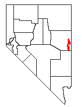 | |
| Country | United States |
| State | Nevada |
| Borders on | Schell Creek Range and Confusion Range |
The Snake Range is a mountain range in the Great Basin region of the Western United States. The range is located in eastern White Pine County of central-eastern Nevada.
Geography
Typical of other ranges in the Basin and Range Province, the Snake Range runs in a north-south direction, for approximately 60 miles (97 km).
To the west are Spring Valley and the Schell Creek Range, and to the east across the Utah border are Snake Valley and the Confusion Range. Sacramento Pass (7,154 feet (2,181 m) is where U.S. Route 6—U.S. Route 50, the "Loneliest Highway in America", crosses the range. It is the principal means of eastbound access to this part of eastern Nevada.


Natural history
Great Basin National Park is located in the southern section of the Snake Range. Established in 1986, it protects the unique geologic and habitat features of the mountain range and Great Basin Desert, and their representations of the Central Basin and Range ecoregion. The southern section also includes the natural rock Lexington Arch (83 feet (25 m) span), and the Lehman Caves, both formed from the range's limestone.
Several large groves of ancient Great Basin Bristlecone Pine (Pinus longaeva) trees thrive in the Great Basin montane forests of the range's higher elevations.
The higher elevations of the Snake Range in the northern section are protected by the Mount Moriah Wilderness Area, and in the southern section by the Highland Ridge Wilderness.


Peaks
Southern
The Snake Range includes two groups of peaks. The southern section rises quickly from a point near the border with Lincoln County, reaching the summit of Granite Peak (11,218 ft, 3419 m) just 10 miles (16 km) to the north.
From there northwards the range continues to rise, passing Lincoln Peak (11,597 ft, 3535 m), Mt. Washington (11,658 ft, 3553 m), Pyramid Peak (11,926 ft, 3635 m), Baker Peak (12,298 ft, 3748 m), Jeff Davis Peak (12,771 ft, 3893 m).
It finally reaching its apex at Wheeler Peak (13,063 ft, 3982 m).
Northern
North of Wheeler Peak the range begins to drop, reaching 7,154 feet (2,181 m) at Sacramento Pass, just 11 miles (18 km) to the north. Sacramento Pass is where the more remote northern section of the range begins.
In just 12 miles (19 km) the range rises past Silver Creek Canyon and Hendrys Creek Canyon to the summit of photogenic Mt. Moriah (12,067 ft, 3678 m). To the north of this peak is an unusual formation, a flat plateau of sub-alpine tundra called "The Table", covering about 2 square miles (5.2 km2) at an elevation of 11,000 feet (3350 m). A grove of ancient Great Basin Bristlecone Pines grows on this plateau near the peak.
North of 'The Table' is another unusual geologic feature. Deadman Creek and Smith Creek, draining eastward into Snake Valley, combine to carve a deep canyon into the range. The mouth of this canyon lies below 3,000-foot (910 m) cliffs, 6,000 feet (1,800 m) below and 6 miles (9.7 km) away from the summit of Mt. Moriah.
| Wikimedia Commons has media related to Snake Range. |