Sladki Vrh
From Wikipedia, the free encyclopedia
| Sladki Vrh | |
|---|---|
_location_map.svg.png) Sladki Vrh | |
| Coordinates: 46°41′44.89″N 15°44′7.89″E / 46.6958028°N 15.7355250°ECoordinates: 46°41′44.89″N 15°44′7.89″E / 46.6958028°N 15.7355250°E | |
| Country |
|
| Traditional region | Styria |
| Statistical region | Drava |
| Municipality | Šentilj |
| Area | |
| • Total | 2.13 km2 (0.82 sq mi) |
| Elevation | 252.1 m (827.1 ft) |
| Population (2002) | |
| • Total | 864 |
| [1] | |
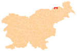
Sladki Vrh is a settlement in the Municipality of Šentilj in northeastern Slovenia, right next to the border with Austria. The main part of the settlement is concentrated on the right bank of the Mura River with the remainder dispersed in the Slovene Hills (Slovene: Slovenske gorice) to the south.[2]
References
External links
| ||||||||||
This article is issued from Wikipedia. The text is available under the Creative Commons Attribution/Share Alike; additional terms may apply for the media files.
