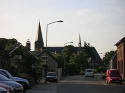
Sint Anthonis
From Wikipedia, the free encyclopedia
| Sint Anthonis | |||
|---|---|---|---|
| Municipality | |||
 | |||
| |||
 | |||
| Coordinates: 51°38′N 05°53′E / 51.633°N 5.883°ECoordinates: 51°38′N 05°53′E / 51.633°N 5.883°E | |||
| Country | Netherlands | ||
| Province | North Brabant | ||
| Area(2006) | |||
| • Total | 99.81 km2 (38.54 sq mi) | ||
| • Land | 99.32 km2 (38.35 sq mi) | ||
| • Water | 0.49 km2 (0.19 sq mi) | ||
| Population (1 January, 2007) | |||
| • Total | 11,770 | ||
| • Density | 119/km2 (310/sq mi) | ||
| Source: CBS, Statline. | |||
| Time zone | CET (UTC+1) | ||
| • Summer (DST) | CEST (UTC+2) | ||


Sint Anthonis (![]() pronunciation (help·info)) is a municipality and a town in the southern Netherlands in the Province of Noord-Brabant. The locals refer to the town as Sint Tunnis. An inhabitant is called a "Sintunnisenaar".
pronunciation (help·info)) is a municipality and a town in the southern Netherlands in the Province of Noord-Brabant. The locals refer to the town as Sint Tunnis. An inhabitant is called a "Sintunnisenaar".
As of January 1, 2011 the town has 4,228 inhabitants.
History
The town was mentioned in a last will as early as 1312. The town was called Oelbroec at the time. As the church of St. Anthony The Abbot was completed in 1477, people started referring to the town as the "Parish of St. Anthony in Oelbroec", and by 1570 the name Oelbroec had disappeared. Church Book registration started in 1640 and are to be found on the BHIC web site.
Population centres
- Landhorst (nl)
- Ledeacker (nl)
- Oploo
- Rijkevoort (nl)
- De Walsert
- Sint Anthonis
- Stevensbeek (nl)
- Wanroij
- Westerbeek (nl)
Topography

Dutch Topographic map of the municipality of Sint Anthonis, 2013.
External links
 Media related to Sint Anthonis at Wikimedia Commons
- Official website
 |
Mill en Sint Hubert | Cuijk | | |
| Uden Boekel |
|
Boxmeer | ||
| ||||
| | ||||
| Gemert-Bakel | Venray (LI) |

This article is issued from Wikipedia. The text is available under the Creative Commons Attribution/Share Alike; additional terms may apply for the media files.