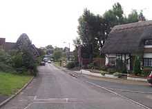
Simpson, Milton Keynes

Simpson is a village and civil parish in Milton Keynes.[1] It was one of the villages of Buckinghamshire that was included in the New City in 1967. It is located south of the centre, just north of Fenny Stratford.
The village name is derived from Old English, and means 'Sigewine's farm'. It was recorded in the Domesday Book of 1086 as Siwinestone,[2] It is the only parish of this name in the United Kingdom, (although there is a hamlet called Simpson in the parish of Nolton and Roche in Wales).
In the mid 19th century the village was described[3] as "in appearance, one of the most wretched of many miserable villages in the county". According to Sheahan, "during the wintertime the main road was generally impassable, without wading through water three feet deep, for a distance of about 200 yards. " he goes on to state that "chiefly through the exertions of Mr. C. Warren, the road has been raised by 3 and a half feet." Charles Warren was the owner of Simpson House and was a substantial landowner and contractor. It would have been in his interest to alleviate flooding in the village, although there is no documentary evidence that he was directly involved in the improvement works.
Civil parish
The civil parish is a small one, consisting of Simpson itself, Ashland and West Ashland. In 1927, the parish included part of Fenny Stratford,[2] but no longer does so.
Ashland
Ashland was best known for the original Milton Keynes Greyhound Stadium, a greyhound racing track. It had been running since the 1960s but was demolished in 2006 to make way for new housing developments. The track was to have been relocated to Elfield Park near the National Bowl but in 2013 this had not yet happened.
West Ashland
This tiny district, logically part of the Denbigh grid-square but severed from it by the A5 dual carriageway, is mostly undeveloped. The only development there to that date is the national headquarters and commissary for Domino's Pizza, UK.
References
- ↑ Parishes in Milton Keynes - Milton Keynes Council.
- ↑ 2.0 2.1 'Parishes : Simpson' – Victoria History of the Counties of England, A History of the County of Buckingham: Volume 4 (1927), pp. 458-462. Date accessed: 30 January 2012.
- ↑ Sheahan, James Joseph, "History and Topography of Buckinghamshire", published in 1862
Coordinates: 52°01′02″N 0°42′51″W / 52.01722°N 0.71417°W