Silver Comet Trail
| Silver Comet Trail | |
|---|---|
 | |
| Length | 61.5 mi (99 km) |
| Location | western Georgia |
| Designation | National Recreation Trail (all or partial?)[1] |
| Trailheads | Smyrna / Georgia-Alabama State Line connecting with the Chief Ladiga Trail |
| Use | Bicycle, Running, Hiking, Dogs on leash, Horseback Riding, Roller/Inline Skating, and Skateboarding[1] |
| Hiking details | |
| Sights | Brushy Mt. Tunnel, |
| Surface | paved |
| Right of way | Seaboard System rail line |
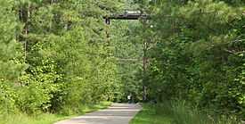
The Silver Comet Trail is a paved, multi-use, recreational trail in western Georgia.
Route
The Silver Comet Trail is a rail trail and is named for the Silver Comet passenger train that used the same route from 1947 to 1969. It begins in Smyrna, Georgia, runs west through Paulding and Polk counties, and connects with Alabama's Chief Ladiga Trail at the Georgia-Alabama border.
As of September 2008, the entire 61.5-mile (99 km) Silver Comet Trail was paved and open for riding.[2] The Silver Comet and Chief Ladiga trails join to form one continuous 94-mile (151 km) trail from Smyrna, Georgia to Anniston, Alabama.[3] Additionally, the Cobb County Department of Transportation has built the Silver Comet Connector, a one-mile extension, to join the Silver Comet Trail with Highland Station, a shopping center at South Cobb Dr. and East-West Connector, Smyrna, Ga.
Planned extensions
Future plans include extending the Georgia end of the trail into the Atlanta city limits.
History
In 1947, the Silver Comet was introduced by the Seaboard Air Line Railroad during the height of passenger rail use. Due to declining ridership, the Silver Comet was downgraded in the 1960s, losing its sleeper-lounger cars. In 1969, the Silver Comet was downgraded again and finally discontinued in June of that year, by Seaboard Coast Line, formed July 1, 1967, by merger of Seaboard Air Line and Atlantic Coast Line.
In 1986, the Seaboard Air Line Railroad's successor, the Seaboard Coast Line, was merged in 1983 with Louisville & Nashville, Georgia Railroad, Atlanta & West Point, Western Railway of Alabama, Clinchfield and Gainesville Midland to form Seaboard System. In 1980 SCL Industries, merged with Chessie System, C&O/B&O/Western Maryland, to form a holding company CSX. The official name change to CSXT, was in July 1987, when SEABOARD SYSTEM, B&O/C&O/WM were merged to form today's CSX Transportation. In 1989, CSX informed the state of Georgia it was abandoning 36 miles (58 km) of railroad from Cobb County through Paulding and Polk counties, which comprised most of the Silver Comet route west of Atlanta. The former SAL mainline is still in place between, Rockmart and Cedartown. It connects with CSXT EX-L&N mainline at Cartersville,Ga, which exist's today. CSXT keeps locomotives at Cedartown for switching jobs on a daily basis between Cedartown and Cartersville. In 2009 BNSF explored the possibility of purchasing the former line, which is RAIL BANKED, meaning the state would allow a railroad to rebuild the track if deemed needed. It is estimated it would take 8–9 months to fully restore the track where it was removed, with rail traffic booming in the 2000s, this is a REAL possibility, that the track could be back in service before 2020.
Rail-trail concept
By 1990, several groups, including the Georgia Rails Into Trails Society, were interested in turning the abandoned rail line into a multi-use trail.
In 1992, the Georgia Department of Transportation bought the abandoned CSX rail line for future use as a high-speed transit route, but later that year, Ron Griffith, Director of Cobb County Parks, requested a lease agreement between Cobb County and the Georgia DOT to use the rail line as a multi-use trail. The Cobb County Board of Commissioners approved the multi-use trail plan in November.
In January 1995, the East-West Connector agreement was signed, including a requirement for Cobb County to develop a plan for converting the rail into a trail.
In 1996, the Cobb County Board of Commissioners allowed Cobb Land Trust a budget of $30,000 to hire a consultant to help develop a design for the multi-use trail.
In 1997, the Board allocated $900,000 for the development of a 2-mile (3.2 km) section of the rail-trail next to Heritage Park to test the multi-use trail idea.
In July 1998, construction of the Silver Comet Trail began through a collaborative effort among the Georgia Department of Transportation, Georgia State Parks, PATH Foundation, Cobb County DOT, Paulding County, and Polk County.
By November 1998, the first section of the Silver Comet Trail opened from Nickajack Creek to Hicks Road.
In 2003, the Silver Comet Trail was recognized by the National Park Service as a National Recreation Trail.
On August 29, 2008, the final portion of the trail was completed. Counting its continuation with the Chief Ladiga Trail to the west, the Silver Comet Trail is now the longest paved trail in the US.[citation needed]
Geology
By riding or walking the Silver Comet Trail, it is immediately obvious that construction of the original Silver Comet Railroad line involved levelling out most of the hills and valleys over which the rails were made to traverse. Most interestingly, where hills were encountered, "road cut" techniques were employed to ensure that the railroad bed was graded as flatly, as possible. The road cuts now reveal many interesting rock formations along the edges of the Silver Comet Trail's pavement. Many of the formations include quite steeply dipping (tilted) layers of metamorphic rocks [4](presumably associated with one or more episodes of mountain-building that produced the Appalachian Mountains, and related physiographic provinces, in Georgia).
In Paulding County, the Silver Comet Trail crosses over the Allatoona Fault in at least three places, and where the trail intersects the fault in the vicinity of Willow Springs Road (currently identifiable as a long wooden automobile bridge high above the trail), the fault serves to divide the quite distinctive Eastern Blue Ridge rocks from those that most characterize the Western Blue Ridge Province.[4]
One rock formation of particular note along the Silver Comet Trail in Paulding County is the Ordovician-age Pumpkinvine Creek Formation (PCF). The PCF is primarily composed of metamorphosed volcanic rocks thought to have originated out in the now-vanished, ancient ocean geologists generally refer to as Iapetus.[5]
Per theory, the PCF, and other such volcanics, formed in the Iapetus as sea-floor rocks (and, perhaps, even entire volcanic islands), but were either ultimately rammed up out of the water by colliding continental masses that finally obliterated the ocean, itself, or, more likely, were extruded locally in back-arc basins landward of a retreating subduction trench, and, due to thrusting, were pushed further onto the margin of what eventually evolved to become our modern North American continent.[6]
The meta-volcanic rocks of the PCF are believed to be remnants of the sort of so-called "accreted terranes" described above, and exposures of PCF rocks can be found on the Silver Comet Trail near the Allatoona Fault.[4]
A detailed geologic map of the area in Paulding County was completed by Christopher S. Holm, Ph.D., and can be viewed at http://etd.lib.fsu.edu/theses/available/etd-11132006-173338/unrestricted/yorkvilleGA.pdf. The map clearly shows the Silver Comet Trail, the Allatoona Fault, and the various rock types a hiker or cyclist will encounter in the above-mentioned section of Paulding County, Georgia.
See also
References
- ↑ 1.0 1.1 Silver Comet Trail. National Recreation Trails database. Page Modified 2011-01-01. Access Date 2011-06-15.
- ↑ "Silver Comet Trail". TrailExpress. Retrieved 2008-09-30.
- ↑ Path Foundation Newsletter
- ↑ 4.0 4.1 4.2 Geologic Map of the Yorkville Quadrangle, Georgia, Mapped by Christopher S. Holm, Ph.D., 2001, Mapping conducted under Educational Mapping Program agreement between USGS, Georgia Geologic Survey, and Florida State University
- ↑ Holm-Denoma, Christopher S., 2006, Florida State University Ph.D. dissertation entitled: CHARACTERIZATION OF PALEOZOIC TERRANES AND TERRANE ACCRETION AT THE SOUTHEASTERN MARGIN OF LAURENTIA: GEORGIA AND ALABAMA APPALACHIANS
- ↑ Holm-Denoma, Christopher S., 2006, Florida State University Ph.D. dissertation entitled: CHARACTERIZATION OF PALEOZOIC TERRANES AND TERRANE ACCRETION AT THE SOUTHEASTERN MARGIN OF LAURENTIA: GEORGIA AND ALABAMA APPALACHIANS
External links
- The Silver Comet Trail in Cobb County, Georgia (official site)
- Silver Comet Trail directions, facts, maps, parking, photos, videos
- Information about the Silver Comet Trail at the PATH Foundation
- PATH Foundation newsletter with construction updates
- Information about the Silver Comet Trail at TrailExpress
- Silver Comet Trail Map (google mashup)
- Silver Comet Trail Page at RailsToTrails.us
- Silver Comet Trail at Georgia's Railroad History and Heritage
- Murder On The Silver Comet Trail by Charlotte Fairchild promoting safety awareness
- Polk County Chamber of Commerce video highlighting the Trail