Shire of Mingenew
| Shire of Mingenew Western Australia | |||||||||||||
|---|---|---|---|---|---|---|---|---|---|---|---|---|---|
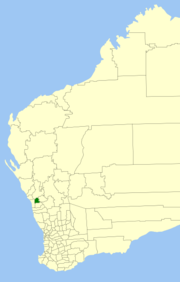 Location in Western Australia | |||||||||||||
| Population | 451 (2011 est)[1] | ||||||||||||
| • Density | 0.23255/km2 (0.6023/sq mi) | ||||||||||||
| Area | 1,939.4 km2 (748.8 sq mi) | ||||||||||||
| Mayor | Michelle Bagley | ||||||||||||
| Council seat | Mingenew | ||||||||||||
| Region | Mid West | ||||||||||||
| State electorate(s) | Moore | ||||||||||||
| Federal Division(s) | Durack | ||||||||||||
|
| |||||||||||||
| Website | www.mingenew.wa.gov.au | ||||||||||||
| |||||||||||||
The Shire of Mingenew is a local government area in the Mid West region of Western Australia, about 110 kilometres (68 mi) southeast of the city of Geraldton and about 370 kilometres (230 mi) north of the state capital, Perth. The Shire covers an area of 1,939 square kilometres (749 sq mi), and its seat of government is the town of Mingenew.
History
The Shire of Mingenew was initially constituted as the Upper Irwin Road District in 1901, over a much larger area. On 12 December 1919, it was renamed the Mingenew Road District. Between 1923 and 1928, it lost 80% of its land area to the neighboring Perenjori-Morawa district and the new districts of Carnamah and Three Springs. By 1930, it had adopted roughly its present boundaries.
On 1 July 1961, it became a shire under the Local Government Act 1960.[2]
On 18 September 2009, the Shires of Mingenew, Three Springs, Morawa and Perenjori announced their intention to amalgamate. A formal agreement was signed five days later, and the name Billeranga was later chosen.[3] However, by February 2011, community pressure had led to the negotiations stalling, and on 16 April 2011, voters from the Shire of Perenjori defeated the proposal at a referendum.[4][5]
Wards
Since 2005 the Shire has been divided into two wards. Prior to this, a five-ward system was in place with the Town Ward having three councillors and the remaining wards one each.
- Rural Ward (three councillors)
- Town Ward (four councillors)
Towns and localities
- Mingenew
- Holmwood
- Ikewa
- Mooriary
- Mount Budd
- Nangetty
- Yandanooka
- Yarragadee
Population
| Year | Population |
|---|---|
| 1933 | 811 |
| 1947 | 690 |
| 1954 | 960 |
| 1961 | 985 |
| 1966 | 978 |
| 1971 | 987 |
| 1976 | 841 |
| 1981 | 736 |
| 1986 | 693 |
| 1991 | 621 |
| 1996 | 586 |
| 2001 | 542 |
| 2006 | 471 |
Sports Clubs
- Mingenew Football Club
- Mingenew Hockey Club
- Mingenew Netball Club
- Mingenew Tennis Club
- Mingenew Cricket Club
- Mingenew Turf Club
- Mingenew Karate Club
- Mingenew Bowls Club
- Mingenew Golf Club
References
- ↑ "3218.0 Regional Population Growth, Australia. Table 5. Estimated Resident Population, Local Government Areas, Western Australia". 30 March 2012. Retrieved 26 May 2012.
- ↑ WA Electoral Commission, Municipality Boundary Amendments Register (release 2.0), 31 May 2003.
- ↑ "Mid-West councils to amalgamate". ABC Online. 18 September 2009.
- ↑ Kennedy, Jane (25 February 2011). "Shire merges hit stalling point". ABC Midwest. Retrieved 26 May 2012.
- ↑ "Perenjori amalgamation not to proceed". Mid West News. 18 April 2011. Retrieved 26 May 2012.
External links
| ||||||||||||||||||||||||||||||||||||||||||||||
Coordinates: 29°11′38″S 115°26′28″E / 29.194°S 115.441°E