Shire of Cunderdin
| Shire of Cunderdin Western Australia | |||||||||||||
|---|---|---|---|---|---|---|---|---|---|---|---|---|---|
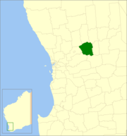 Location in Western Australia | |||||||||||||
| Population | 1,280 (2011 est)[1] | ||||||||||||
| • Density | 0.6866/km2 (1.778/sq mi) | ||||||||||||
| Area | 1,864.2 km2 (719.8 sq mi) | ||||||||||||
| Mayor | Graham Cooper | ||||||||||||
| Council seat | Cunderdin | ||||||||||||
| Region | Wheatbelt | ||||||||||||
| State electorate(s) | Central Wheatbelt | ||||||||||||
| Federal Division(s) | Durack | ||||||||||||
| Website | www.cunderdin.wa.gov.au | ||||||||||||
| |||||||||||||
The Shire of Cunderdin is a local government area located in the Wheatbelt region of Western Australia, about 105 kilometres (65 mi) west of Merredin and about 155 kilometres (96 mi) east of Perth, the state capital. The Shire covers an area of 1,864 square kilometres (720 sq mi), and its seat of government is the town of Cunderdin.
History
On 14 December 1894, the Meckering Road District was created, changing its name to Cunderdin on 3 November 1944. On 1 July 1961, it became a Shire following the enactment of the Local Government Act 1960.[2]
Wards
All wards in the shire were abolished before the 3 May 2003 election. Prior to this, it had 8 councillors representing two wards - West Ward (3 councillors) and Central Ward (5 councillors).
Towns and localities
Population
| Year | Population |
|---|---|
| 1911 | 2,115 |
| 1921 | 2,183 |
| 1933 | 2,745 |
| 1947 | 2,445 |
| 1954 | 2,130 |
| 1961 | 2,014 |
| 1966 | 2,114 |
| 1971 | 1,862 |
| 1976 | 1,586 |
| 1981 | 1,630 |
| 1986 | 1,484 |
| 1991 | 1,389 |
| 1996 | 1,368 |
| 2001 | 1,374 |
| 2006 | 1,250 |
References
- ↑ "3218.0 Regional Population Growth, Australia. Table 5. Estimated Resident Population, Local Government Areas, Western Australia". 30 March 2012. Retrieved 26 May 2012.
- ↑ WA Electoral Commission, Municipality Boundary Amendments Register (release 3.0), 31 July 2007.
External links
| ||||||||||||||||||||||||||||||||||||||||||||||
Coordinates: 31°39′22″S 117°14′38″E / 31.656°S 117.244°E