Shire of Carnarvon
| Shire of Carnarvon Western Australia | |||||||||||||
|---|---|---|---|---|---|---|---|---|---|---|---|---|---|
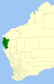 Location in Western Australia | |||||||||||||
| Population | 6,333 (2011 est)[1] | ||||||||||||
| • Density | 0.135716/km2 (0.351504/sq mi) | ||||||||||||
| Established | 1965 | ||||||||||||
| Area | 46,663.5 km2 (18,016.9 sq mi) | ||||||||||||
| Shire President | Karl Brandenburg | ||||||||||||
| Council seat | Carnarvon | ||||||||||||
| Region | Gascoyne | ||||||||||||
| State electorate(s) | North West | ||||||||||||
| Federal Division(s) | Durack | ||||||||||||
| Website | www.carnarvon.wa.gov.au | ||||||||||||
| |||||||||||||
The Shire of Carnarvon is a local government area in the Gascoyne region of Western Australia, located about 900 kilometres (559 mi) north of the state capital, Perth. The Shire covers an area of 46,664 square kilometres (18,017 sq mi), and its seat of government is the town of Carnarvon. The major industries in the area are wool, agriculture (especially bananas and tomatoes) and, more recently, tourism.
History
Carnarvon started as three entities
- the Carnarvon Municipality, which governed the town of Carnarvon and was constituted in 1891;
- the Lower Gascoyne Road District (1887)
- the Minilya Road District (1893).
In 1911, the two road districts merged to form the Gascoyne-Minilya Road District. On 1 July 1961, Carnarvon became a town and Gascoyne-Minilya a shire under the Local Government Act 1960. On 1 March 1965, the two entities merged to form the Shire of Carnarvon.[2]
Wards
The Shire is divided into 4 wards, most of which have one councillor. The Shire President is directly elected.
- Town Ward (6 councillors)
- Plantation Ward
- Gascoyne/Minilya North
- Gascoyne/Minilya South
Towns and localities
References
- ↑ "3218.0 Regional Population Growth, Australia. Table 5. Estimated Resident Population, Local Government Areas, Western Australia". 30 March 2012. Retrieved 26 May 2012.
- ↑ WA Electoral Commission, Municipality Boundary Amendments Register (release 3.0), 31 May 2007.
External links
| ||||||||||||||||||||||||||||||||||||||||||||||
Coordinates: 24°53′02″S 113°39′40″E / 24.884°S 113.661°E