Shire of Bungil
| Shire of Bungil Queensland | |||||||||||||
|---|---|---|---|---|---|---|---|---|---|---|---|---|---|
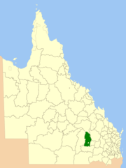 Location within Queensland | |||||||||||||
| Population | 1,980 (2001 census) | ||||||||||||
| • Density | 0.1484/km2 (0.3845/sq mi) | ||||||||||||
| Established | 1880 | ||||||||||||
| Abolished | 2008 | ||||||||||||
| Area | 13,338 km2 (5,149.8 sq mi) | ||||||||||||
| Council seat | Roma | ||||||||||||
| Region | Maranoa | ||||||||||||
|
| |||||||||||||
| Website | www.bungil.qld.gov.au/index.shtml | ||||||||||||
| |||||||||||||
The Shire of Bungil was a local government area in the Maranoa region of Queensland, Australia.[1] It existed from 1880 to 2008.
The shire surrounded the town of Roma, which had its own local government. Roma was also the location of the administration of Bungil Shire. Today it is part of the Maranoa Region.
History

Wallumbilla Division (later renamed Booringa Division) was established on 11 November 1879 as one of the original divisions proclaimed under the Divisional Boards Act 1879 with a population of 3217.[2] On 21 May 1880, part of Wallumbilla Division was separated to create Bungil Division.[3]
On 31 March 1903, Bungil Division became Shire of Bungil under the "Local Authorities Act 1902".[1]
In July 2007, the Local Government Reform Commission released a report recommending a number of amalgamations of local government areas in Queensland. As a result, under the Local Government (Reform Implementation) Act 2007, on 15 March 2008, the new local government area of Roma Region was created, as an amalgamation of five previous local government areas:[4]
- Shire of Bendemere
- Shire of Booringa
- Shire of Bungil
- Town of Roma
- Shire of Warroo
On 26 July 2009, Roma Region was renamed Maranoa Region.[4]
Towns and localities
Towns in the shire included Injune and Muckadilla. The Great Dividing Range passes though the shire.
Chairmen and mayors
- 1918: P. Hoskin[5]
- 2000 - 2008: Robert ("Scruff") Loughnan[6][7] (subsequently mayor of Maranoa Regional Council)
References
- ↑ 1.0 1.1 "Agency ID363, Bungil Shire Council". Queensland State Archives. Retrieved 8 September 2013.
- ↑ "Proclamation [Wallumbilla Division]". Queensland Government Gazette. 11 November 1879. p. 25:999.
- ↑ Queensland Government Gazette. 22 May 1880. p. 26:1145.
- ↑ 4.0 4.1 "Agency ID11033, Maranoa Regional Council". Queensland State Archives. Retrieved 5 September 2013.
- ↑ Consolidated Index to Queensland Government Gazette 1859-1919. Queensland Family History Society. 2004. ISBN 1 876613 79 3.
- ↑ "MAYOR - Councillor Robert Loughnan". Maranoa Regional Council. Retrieved 22 January 2014.
- ↑ "Cr Robert "Scruff" Loughnan". Robert Lougnan. Retrieved 22 January 2014.
External links
- Queensland Department of Local Government & Planning - Local Government Directory
| ||||||||||||||||||||
Coordinates: 26°34′18″S 148°47′21″E / 26.57167°S 148.78917°E