Seward, Illinois
From Wikipedia, the free encyclopedia
| Seward | |
| Unincorporated | |
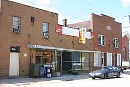
 Post office and buildings on the main street | |
| Country | United States |
|---|---|
| State | Illinois |
| County | Winnebago |
| Township | Seward |
| Elevation | 896 ft (273 m) |
| Coordinates | 42°14′09″N 89°21′28″W / 42.23583°N 89.35778°W |
| Population | 200 (2000) |
| Founded | 1818 |
| Timezone | CST (UTC-6) |
| - summer (DST) | CDT (UTC-5) |
| Postal code | 61077 |
| Area code | 815 |
  Location of Seward within Illinois
| |
| Wikimedia Commons: Seward, Illinois | |
Seward is an unincorporated community in Winnebago County, Illinois, and is located west of Rockford. It is part of the Rockford, Illinois Metropolitan Statistical Area.
In early 2007, a leak at Seward Ag caused the release of 38,000 to 40,000 pounds of anhydrous ammonia gas. This resulted in a full evacuation of the village until the next day. Ten people were treated for throat irritation at Rockford hospitals. Three cows and four pigs were killed because of exposure to anhydrous ammonia.
Geography
Demographics
References
External links
| ||||||||||||||||||||||||||
This article is issued from Wikipedia. The text is available under the Creative Commons Attribution/Share Alike; additional terms may apply for the media files.