| Scoppito |
|---|
|
Comune |
| Comune di Scoppito |
|---|

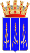
Coat of arms | |
|
Location of Scoppito in Italy
|
|
Coordinates: 42°22′26″N 13°51′21″E / 42.37389°N 13.85583°E / 42.37389; 13.85583Coordinates: 42°22′26″N 13°51′21″E / 42.37389°N 13.85583°E / 42.37389; 13.85583 |
| Country |
Italy |
|---|
| Region |
Abruzzo |
|---|
| Province |
L'Aquila (AQ) |
|---|
| Frazioni |
Scoppito, Civitatomassa, Collettara, Santa Dorotea, Santa Maria, Casale, Forcellette, Cave, Vallinsù, Cupoli, Madonna della Strada, Vigliano, Sella di Corno |
|---|
| Government |
|---|
| • Mayor |
Angelo Cortelli |
|---|
| Area |
|---|
| • Total |
53.02 km2 (20.47 sq mi) |
|---|
| Elevation |
820 m (2,690 ft) |
|---|
| Population (2005) |
|---|
| • Total |
2,857 |
|---|
| • Density |
54/km2 (140/sq mi) |
|---|
| Demonym |
Scoppitani |
|---|
| Time zone |
CET (UTC+1) |
|---|
| • Summer (DST) |
CEST (UTC+2) |
|---|
| Postal code |
67019 |
|---|
| Dialing code |
0862 |
|---|
| Saint day |
July 25 |
|---|
| Website |
Official website |
|---|
Scoppito is a
comune and
town in the
province of L'Aquila, in the Baschi region of southern
Italy.
Sports
S.P.D. Amiternina
S.P.D. Amiternina[1] is an Italian association football club, based in this city.
In the season 2011-12 the team was promoted for the first time, from Eccellenza Abruzzo to Serie D after.
Its colors are yellow and red.
See also
References
|
|---|
| | Girone A | |
|---|
| | Girone B | |
|---|
| | Girone C | |
|---|
| | Girone D | |
|---|
| | Girone E | |
|---|
| | Girone F | |
|---|
| | Girone G | |
|---|
| | Girone H | |
|---|
| | Girone I | |
|---|
|
|
|---|
|
- 1948–49
- 1949–50
- 1950–51
- 1951–52
- 1952–53
- 1953–54
- 1954–55
- 1955–56
- 1956–57
- 1957–58
- 1958–59
- 1959–60
- 1960–61
- 1961–62
- 1962–63
- 1963–64
- 1964–65
- 1965–66
- 1966–67
- 1967–68
- 1968–69
- 1969–70
- 1970–71
- 1971–72
- 1972–73
- 1973–74
- 1974–75
- 1975–76
- 1976–77
- 1977–78
- 1978–79
- 1979–80
- 1980–81
- 1981–82
- 1982–83
- 1983–84
- 1984–85
- 1985–86
- 1986–87
- 1987–88
- 1988–89
- 1989–90
- 1990–91
- 1991–92
- 1992–93
- 1993–94
- 1994–95
- 1995–96
- 1996–97
- 1997–98
- 1998–99
- 1999–2000
- 2000–01
- 2001–02
- 2002–03
- 2003–04
- 2004–05
- 2005–06
- 2006–07
- 2007–08
- 2008–09
- 2009–10
- 2010–11
- 2011–12
- 2012–13
- 2013–14
|
|
|
|---|
| | Overview | |
|---|
| | International | |
|---|
| | Leagues | |
|---|
| | League competitions | |
|---|
| | Cup competitions | |
|---|
| | Youth competitions | |
|---|
| | Women's competitions | |
|---|
| | Awards | |
|---|
| | Miscellaneous | |
|---|
| | Seasons | |
|---|
|

