Schynige Platte
| Schynige Platte | |
|---|---|
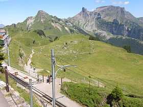
 Schynige Platte view (the railway station is visible) | |
| Elevation | 2,076 m (6,811 ft) |
| Location | |
 Schynige Platte | |
| Location | Switzerland |
| Range | Bernese Alps |
| Coordinates | 46°39′22″N 7°54′25″E / 46.65611°N 7.90694°ECoordinates: 46°39′22″N 7°54′25″E / 46.65611°N 7.90694°E |
| Climbing | |
| Easiest route | Railway |
The Schynige Platte is a Swiss mountain region near Wilderswil where the Schynige Platte Railway ends. It lies at the western end of a prominent ridge in the Bernese Oberland. In good weather conditions the summit offers spectacular views to many surrounding mountains, including Jungfrau, Eiger, Silberhorn, and others. Also, the two lakes of Thunersee and Brienzersee are visible to the North, over 1,500 metres (4,921 ft) lower.

An alpine garden is located near the summit where various alpine plants can be found together with labels, indicating their Latin names (many of these plants also grow around as wild species). At the top of the railway station there is a hotel and mountain restaurant.
Hiking
Schynige Platte is a starting point for the popular hiking trails to Faulhorn or First. A number of shorter loop trails also extend east from the train station, reaching Oberberghorn and Loucherhorn.
External links
| Wikimedia Commons has media related to Schynige Platte. |