Schous plass

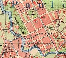
Schous plass (lit. "Schou's Square") is a square placed in the south of the borough Grünerløkka in Oslo, Norway.
History
The area belonged to Aker municipality until 1858, when it was incorporated into Christiania (Oslo).[1] It was laid out in 1873, and got its name in 1874. Its namesake was brewery owner Christian Schou, who died in the same year.[2] Not far away, at the property Schousløkken in the street Trondheimsveien, he had established production facilities of his beer brewery Schous Bryggeri between 1872 and 1874.[3][4] A park was established at the square between 1915 and 1916, and renovated in 1986.[2]

The square is surrounded by four streets and buildings. The local library, administratively a satellite of the Deichman Library, was raised here between 1912 and 1914. A building for the Norwegian School of Marketing (Norwegian: Norges Markedshøyskole) was erected between 1989 and 1990.[2] This institution was incorporated into the Norwegian School of Management in 1992, an institution which had its headquarters in Sandvika at the time, and only a satellite at Schous plass. The Norwegian School of Management concentrated its Oslo and Sandvika institutions into one school at Nydalen in 2005.[5] Among the most notable residents of the buildings at Schous plass are a young adult Edvard Munch, who lived at the address Schous plass 1 from 1885 to 1889.[2]
Transport
| Schous plass | |
|---|---|
| Station statistics | |
| Address |
Grünerløkka, Oslo Norway |
| Coordinates | 59°55′15″N 10°45′34″E / 59.9208°N 10.7594°E |
| Line(s) |
|
Schous plass is a light rail station on the Grünerløkka–Torshov Line of the Oslo Tramway. It is served by lines 11, 12 and 13.[6] The square is not directly served by bus.
References
- ↑ Tvedt, Knut Are, ed. (2000). "Grünerløkka". Oslo byleksikon (4th ed.). Oslo: Kunnskapsforlaget. pp. 170–171. ISBN 82-573-0815-3.
- ↑ 2.0 2.1 2.2 2.3 Tvedt, Knut Are, ed. (2000). "Schous plass". Oslo byleksikon (4th ed.). Oslo: Kunnskapsforlaget. p. 381. ISBN 82-573-0815-3.
- ↑ Tvedt, Knut Are, ed. (2000). "Schous Bryggeri". Oslo byleksikon (4th ed.). Oslo: Kunnskapsforlaget. p. 381. ISBN 82-573-0815-3.
- ↑ Tvedt, Knut Are, ed. (2000). "Schousløkken". Oslo byleksikon (4th ed.). Oslo: Kunnskapsforlaget. p. 381. ISBN 82-573-0815-3.
- ↑ Henriksen, Petter, ed. (2007). "Handelshøyskolen BI". Store norske leksikon (in Norwegian). Oslo: Kunnskapsforlaget. Retrieved 21 April 2010.
- ↑ Oslo Sporveier. "Linjekart". Retrieved 18 March 2009.
| TERMINUS | NEXT STATION ← WEST |
Schous plass | NEXT STATION EAST→ |
TERMINUS | ||
|---|---|---|---|---|---|---|
| Majorstuen | Nybrua | Line 11 | Olaf Ryes plass | Kjelsås | ||
| Majorstuen | Line 12 | Kjelsås | ||||
| Jar | Line 13 | Grefsen | ||||
| |||||||||||||||||||||||||||||
Coordinates: 59°55′14″N 10°45′37″E / 59.9206°N 10.7602°E