Schenectady County, New York
| Schenectady County, New York | ||
|---|---|---|
| ||
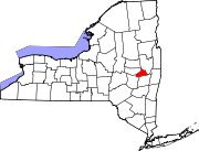 Location in the state of New York | ||
 New York's location in the U.S. | ||
| Founded | 1809 | |
| Seat | Schenectady | |
| Largest city | Schenectady | |
| Area | ||
| • Total | 210 sq mi (544 km2) | |
| • Land | 206 sq mi (534 km2) | |
| • Water | 4 sq mi (10 km2), 1.68% | |
| Population | ||
| • (2010) | 154,727 | |
| • Density | 750/sq mi (289.7/km²) | |
| Website | www.schenectadycounty.com | |

Schenectady County is a county located in the U.S. state of New York. As of the 2010 census, the population was 154,727.[1] It is part of the Albany-Schenectady-Troy Metropolitan Statistical Area. The county seat is Schenectady. The name is from a Mohawk Indian word meaning "on the other side of the pine lands" and is pronounced /skəˈnɛktədi/.
History

Schenectady County was formed in 1809. When counties were established in New York in 1683, the present Schenectady County was included in Albany County. Albany County was an enormous county, including the northern part of New York State as well as all of the present State of Vermont and, in theory, extending westward to the Pacific Ocean. This county was reduced in size on July 3, 1766, by the creation of Cumberland County, and further on March 16, 1770, by the creation of Gloucester County, both containing territory now in Vermont.
On March 12, 1772, Albany County was divided into the counties of Albany, Tryon (now Montgomery), and Charlotte (now Washington).
From 1772 to 1786 Albany County included, besides the present territory of Albany County, all of the present Columbia, Rensselaer, Saratoga, and Schenectady counties, parts of the present Greene and Washington counties, and a piece of what is now southwestern Vermont.
Albany County was reduced in size in 1786 by the splitting off of Columbia County; again in 1791 by the splitting off of Rensselaer and Saratoga counties and the transfer of the Town of Cambridge to Washington County. It was further reduced in size in 1795 by the splitting off of a part that was combined with a portion of Otsego County to create Schoharie County. It was further reduced in size in 1800 by the splitting off of a part that was combined with a portion of Ulster County to create Greene County.
In 1809, Schenectady County was split from Albany County.
Geography
Schenectady County is located in east central New York State, north of Albany.
According to the U.S. Census Bureau, the county has a total area of 543 km² (210 sq mi). 534 km² (206 sq mi) of it is land and 9 km² (4 sq mi) of it (1.68%) is water.[2]
Adjacent counties
- Saratoga County, New York - east
- Albany County, New York - south
- Schoharie County, New York - southwest
- Montgomery County, New York - west
Demographics
| Historical population | |||
|---|---|---|---|
| Census | Pop. | %± | |
| 1810 | 10,201 | ||
| 1820 | 13,081 | 28.2% | |
| 1830 | 12,347 | −5.6% | |
| 1840 | 17,387 | 40.8% | |
| 1850 | 20,054 | 15.3% | |
| 1860 | 20,002 | −0.3% | |
| 1870 | 21,347 | 6.7% | |
| 1880 | 23,538 | 10.3% | |
| 1890 | 29,797 | 26.6% | |
| 1900 | 46,852 | 57.2% | |
| 1910 | 88,235 | 88.3% | |
| 1920 | 109,363 | 23.9% | |
| 1930 | 125,021 | 14.3% | |
| 1940 | 122,494 | −2.0% | |
| 1950 | 142,497 | 16.3% | |
| 1960 | 152,896 | 7.3% | |
| 1970 | 160,979 | 5.3% | |
| 1980 | 149,946 | −6.9% | |
| 1990 | 149,285 | −0.4% | |
| 2000 | 146,555 | −1.8% | |
| 2010 | 154,727 | 5.6% | |
| Est. 2012 | 155,124 | 0.3% | |
2012 Estimate[1] | |||
As of the census[4] of 2010, there were 154,727 people, 60,684 households, and 39,918 families residing in the county. The population density was 275/km² (711/sq mi). There were 68,032 housing units at an average density of 122/km² (316/sq mi). The racial makeup of the county was 79.77% White, 9.79% Black or African American, 0.23% Native American, 3.97% Asian, 0.03% Pacific Islander, 1.21% from other races, and 2.00% from two or more races. 6.17% of the population were Hispanic or Latino of any race. 24.3% were of Italian, 14.7% Irish, 8.7% German, 6.4% Polish, 4.0 Puerto Rican, 3.9% English ancestry according to Census 2010.[5] 87.6% spoke English, 4.7% Spanish and 1.1% Italian as their first language.
There were 60,684 households out of which 30.00% had children under the age of 18 living with them, 45.50% were married couples living together, 14.30% had a female householder with no husband present, and 36.30% were non-families. 30.60% of all households were made up of individuals and 12.60% had someone living alone who was 65 years of age or older. The average household size was 2.58 and the average family size was 3.17.
In the county the population was spread out with 24.30% under the age of 18, 7.90% from 18 to 24, 28.10% from 25 to 44, 23.00% from 45 to 64, and 16.60% who were 65 years of age or older. The median age was 39 years. For every 100 females there were 92.60 males. For every 100 females age 18 and over, there were 88.30 males.
The median income for a household in the county was $53,399 ($41,739-2000), and the median income for a family was $57,670. Males had a median income of $41,840 versus $29,339 for females. The per capita income for the county was $24,992. About 7.80% of families and 11.90% of the population were below the poverty line, including 17.70% of those under age 18 and 5.50% of those age 65 or over.
Communities
Cities and Towns:
Schenectady, Duanesburg, Glenville, Niskayuna, Princetown, Rotterdam
Villages:
Delanson, Scotia
Hamlets:
Alplaus, Duanesburg, Duane Lake, East Glenville, Mariaville Lake, Niskayuna, Pattersonville-Rotterdam Junction, Rotterdam
Politics and government
Schenectady County typically leans Democratic, it has given small to moderate leads to Democrats since 1988 in presidential elections. The congressman Paul Tonko is a Democrat. Legislative authority is vested in the County Legislature, which consists of 15 members representing 8 different communities, separated into four districts. The current composition of the Legislature is as follows (13 Democrats, 1 Republican, and 1 Conservative who caucuses with the Democrats):
District 1 - Schenectady:
- Robert W. Hoffman (D)
- Karen B. Johnson (D), Vice Chair
- Michael Petta (D)
District 2 - Schenectady:
- Philip Fields (D)
- Gary Hughes (D), Majority Leader
- Jeffrey M. McDonald (D)
District 3 - Glenville, Niskayuna, and Scotia:
- James Buhrmaster (R), Minority Leader
- Thomas Constantine (D)
- Martin Finn (D)
- Cathy Gatta (D)
- Brian Gordon (D), Deputy Chair
District 4 - Duanesburg, Princetown, and Rotterdam:
- Judith Dagostino (D), Chair
- Anthony Jasenski (D)
- Angelo Santabarbara (D)
- Holly Vellano (C)
County services
The county operates the Schenectady County Public Library that consists of a central library and nine branches.
See also
- List of counties in New York
- National Register of Historic Places listings in Schenectady County, New York
Notes
- ↑ 1.0 1.1 "State & County QuickFacts". United States Census Bureau. Retrieved October 13, 2013.
- ↑ "US Gazetteer files: 2010, 2000, and 1990". United States Census Bureau. 2011-02-12. Retrieved 2011-04-23.
- ↑ "U.S. Decennial Census". Census.gov. Retrieved October 13, 2013.
- ↑ "American FactFinder". United States Census Bureau. Retrieved 2008-01-31.
- ↑ American FactFinder. Factfinder.census.gov. Retrieved on 2013-08-16.
Further reading
- Yates, Austin A. (1902). Schenectady County, New York: Its History to the Close of the Nineteenth Century. the New York History Company.
- Lockhart, Charlotte (1921). Family Bible Records of Schenectady County. Unknown.
External links
| Wikimedia Commons has media related to Schenectady County, New York. |
 |
Montgomery County | Saratoga County | | |
| |
||||
| ||||
| | ||||
| Schoharie County | Albany County |
| |||||||||||||||||||||||

| ||||||||||||||||||||
Coordinates: 42°49′N 74°04′W / 42.81°N 74.07°W